
AI site selection platform
Find your next development site.
In minutes.
Search thousands of parcels, find the sites that fit, understand what you can build, and manage every opportunity from one place.
160M+
20,000+
600,000+
1,200+
Working with Industry Leaders
We partner with leading organizations across real estate, technology, and government sectors.







Finding Opportunities Others Miss
"ArchiWise replaced digging through municipal code sites, zoning maps, and PDFs across a dozen tabs - now it's one place. Unlike general AI tools, it's built specifically for property analysis."

"We were about to make an offer on a mixed-use site. ArchiWise flagged that parking requirements would cut 22% of our leasable space, turning a 14% IRR into a loss. Caught it before we made a costly mistake."

"We cut due diligence from 6 weeks to 8 days. With ArchiWise, we analyze sites faster and understand constraints earlier, so we make strong offers while others are still waiting on zoning reports."

"ArchiWise flagged an overlay zone restriction that our title company and attorney both missed - one that would have cost $380K in redesign and 6 months of delay."

The decision chain
Make site decisions in hours, not weeks.
Search, screen and evaluate development sites without jumping between mapping tools, zoning databases, spreadsheets and property records. Pick a step to see how it works.
Find land
Stop searching parcel by parcel.
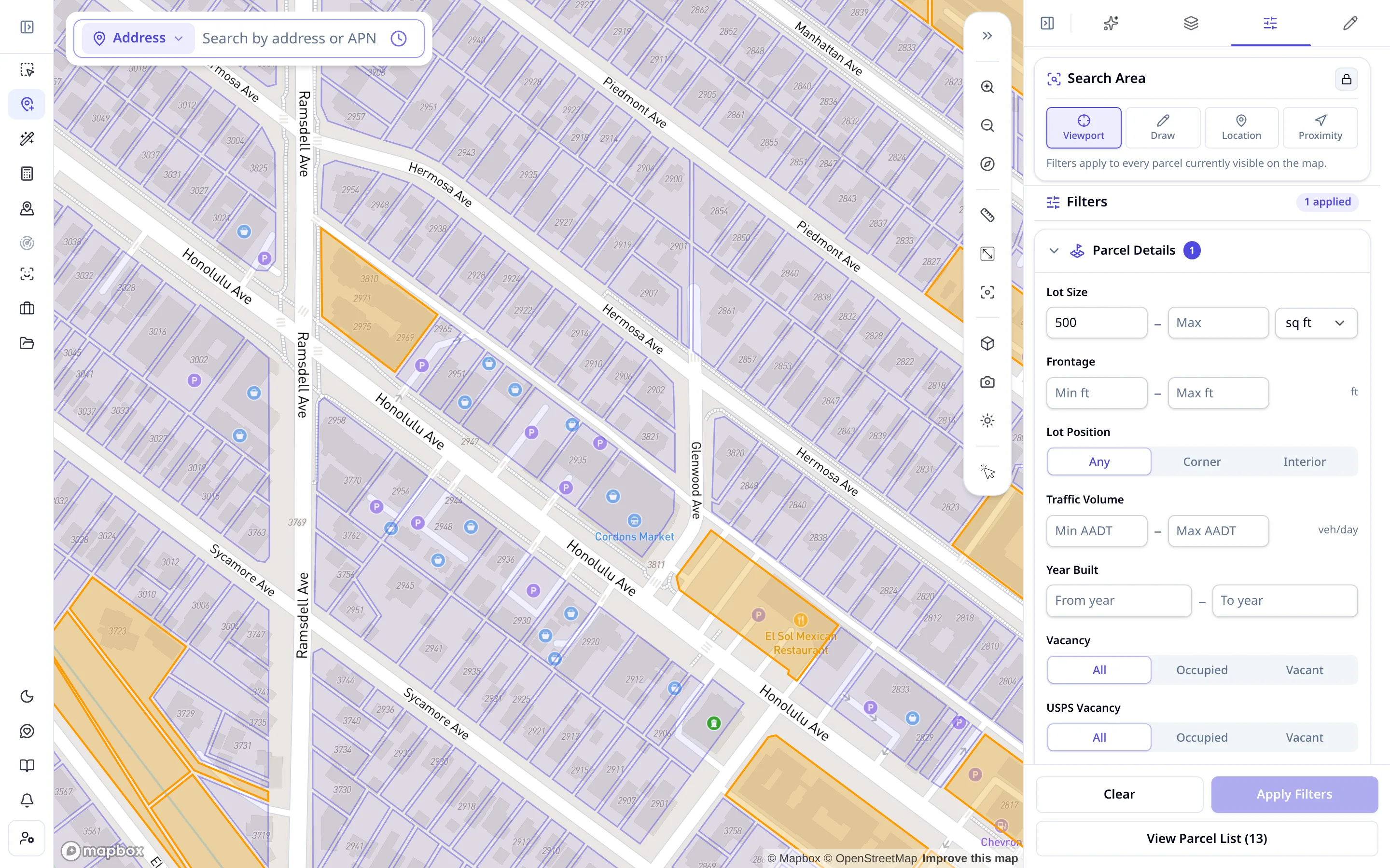
Pick your search area on the map or describe the site you want in plain language, then narrow thousands of parcels down to the ones worth opening.
- Search by viewport, drawn area, location or drive time
- Filter by lot size, zoning, frontage, traffic, vacancy and use
- Matching parcels highlight on the map as you refine
- Review results as a list and open any parcel record
Screen the site
Kill bad sites before they waste your time.
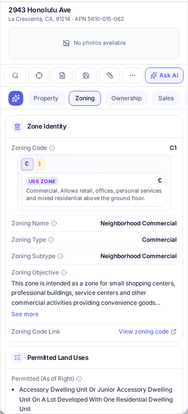
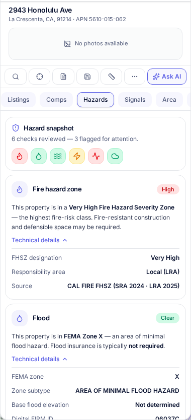
See zoning, Future Land Use, hazards, frontage, traffic, ownership, sales, permits and other property data in one place.
- Zoning district and what it permits, setbacks, height, FAR
- Future Land Use designation and overlays
- Flood and hazard flags, frontage and traffic counts
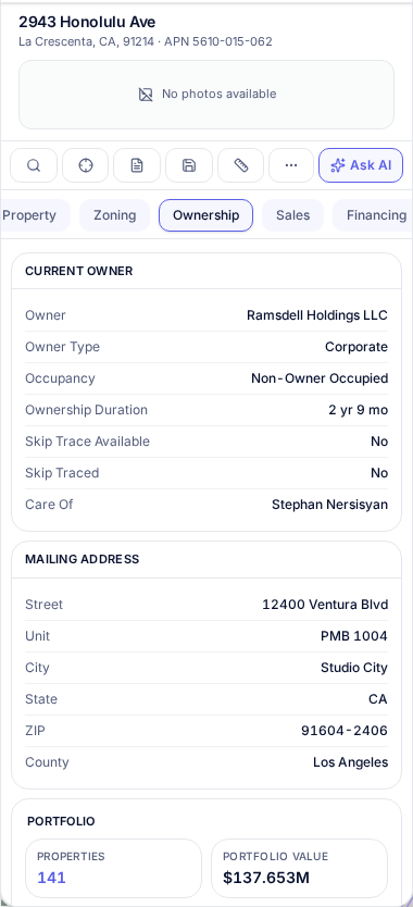
- Ownership, sales history, taxes and permit activity
2943 Honolulu Ave
La Crescenta, CA · APN 5610-015-062
Test Feasibility
Know what you can build before you bid.
Turn a parcel into a quick development scenario. Test massing, units, area, height and key financial assumptions without leaving the site.
- Massing generated on the real parcel inside its zoning limits
- Units, gross floor area, FAR, coverage and height
- Cost, revenue and yield on cost update as you change the scheme
- Save scenarios and switch between alternatives
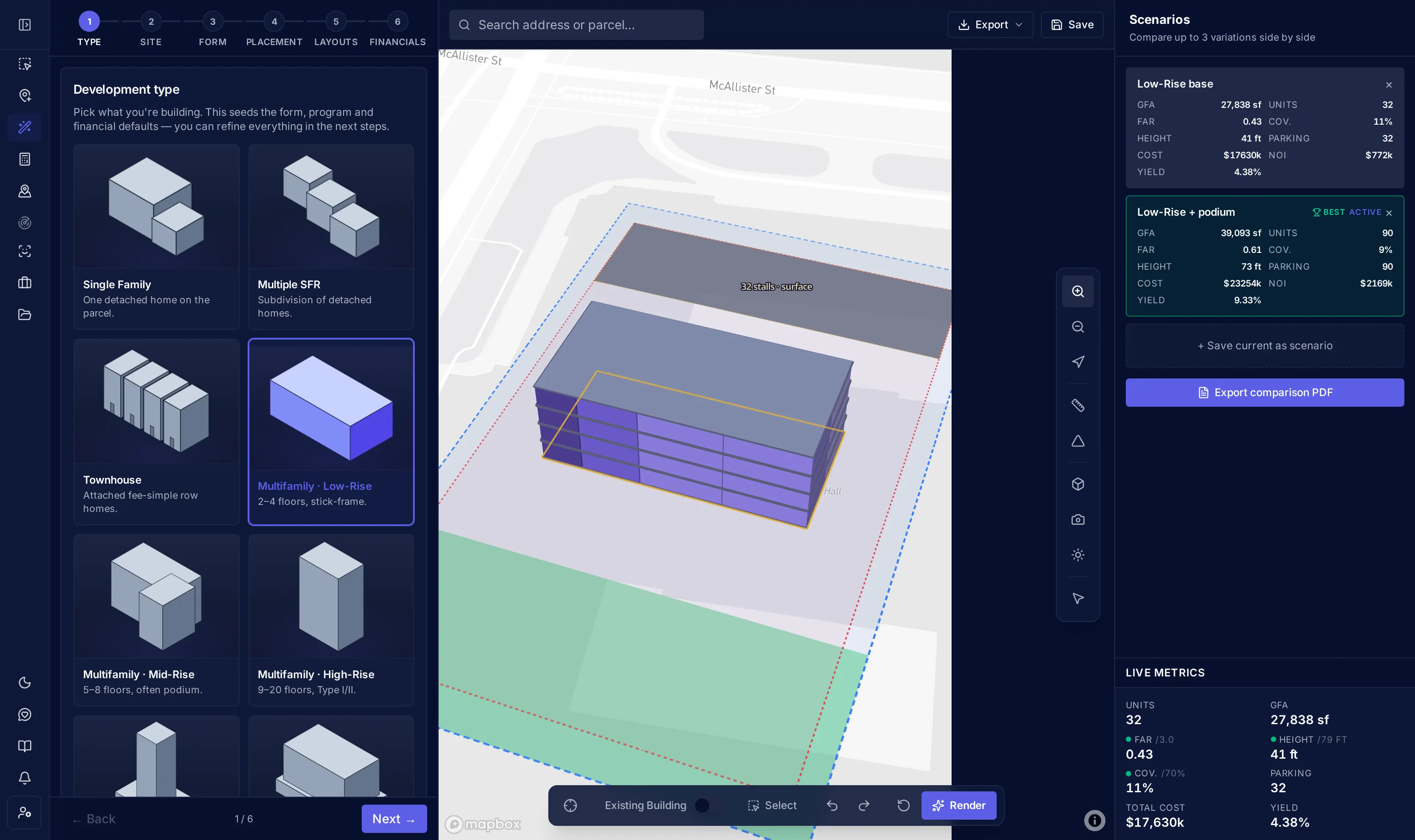
Units
32
GFA
27,838 sf
FAR
0.43 / 3.0
Height
41 ft
Contact the Owner
Get to the owner before your competitors do.
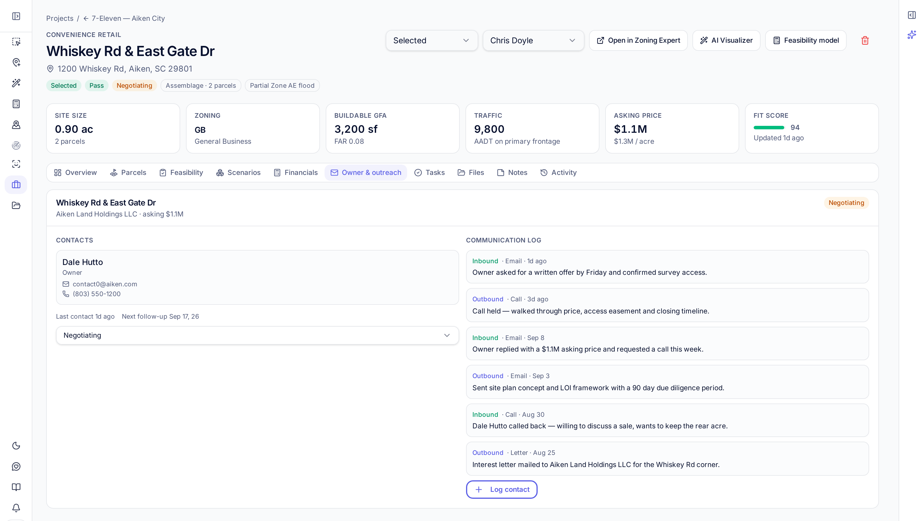
See ownership information and available contact details, then keep outreach and activity connected to the opportunity.
- Owning entity, owner type, occupancy and how long they have held it
- Mailing address and other parcels in the same portfolio
- Log calls, emails and next follow-ups against the site
- Contact details depend on what public records make available
Run deals to acquisition
Turn shortlisted sites into acquisitions.
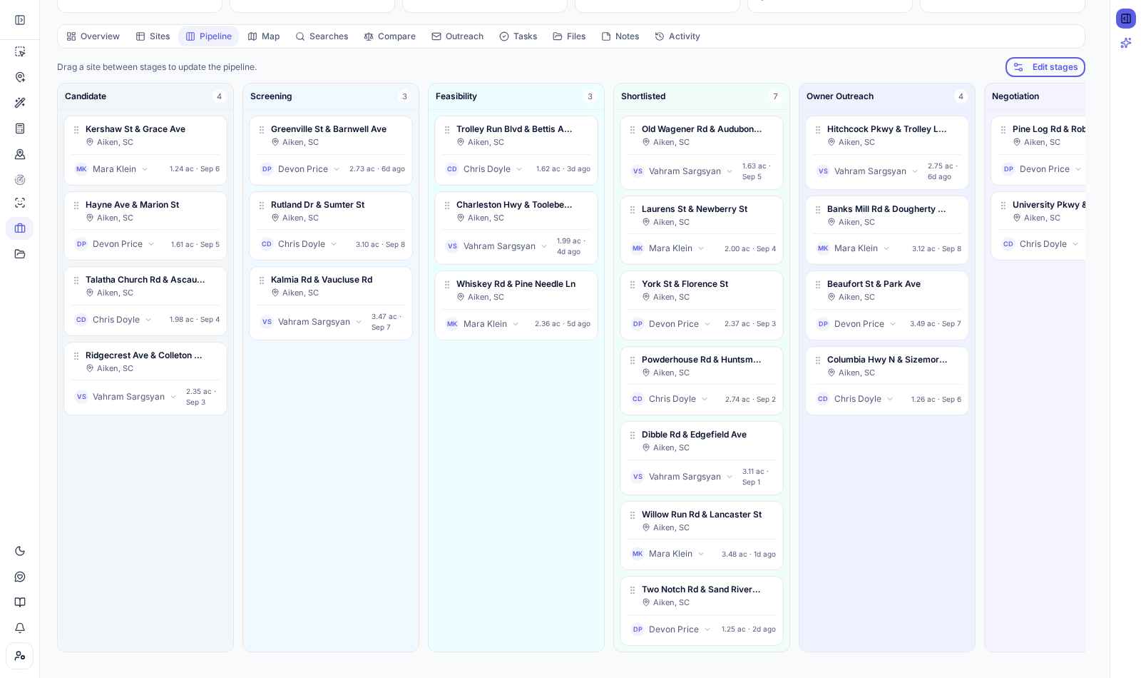
Save sites into projects, move opportunities through your pipeline, assign teammates and keep notes, files, comparisons and reports together.
- Pipeline board and sites table, with stages you change inline
- Projects per market or program, shared with your team
- Owners and collaborators assigned per site
- Notes, files, tasks, comparisons and reports on the record
FAQ
Site selection questions, answered
Still curious? Reach out and we'll walk you through it.
Site selection software helps real estate acquisition teams find and evaluate development sites. Instead of switching between mapping tools, county zoning databases, spreadsheets and property records, you search parcels across a market, filter them by criteria such as lot size, zoning, frontage and traffic, review the full property record, and move the sites worth pursuing into a pipeline. ArchiWise adds development feasibility and ownership data to that same workflow.
Start with your criteria: the area you want, minimum lot size, zoning or Future Land Use category, road frontage, traffic counts, whether the parcel is vacant, and hazards you want to exclude. In ArchiWise you draw or pick the search area, apply those filters or describe the site in plain language, and get a ranked list of matching parcels on the map. From there you open each parcel record, compare a shortlist, and save the strongest sites to a project.
Open the parcel and read its zoning record: the zoning district and what it permits, the Future Land Use designation, setbacks, height limits, FAR and coverage, plus overlays and hazard flags. Because zoning analysis sits on the same record as ownership, sales history, permits and traffic, you can judge whether a site supports your program without calling the planning department first.
Yes. You can put up to five sites side by side and compare lot size, zoning, Future Land Use, hazards, frontage, asking price or assessed value, price per acre and development capacity, with the strongest value in each row highlighted. Comparisons stay attached to the project so your team reviews the same shortlist.
Find the Sites Worth Pursuing
Drop in a market you're working on and see which sites deserve a closer look.
Get the full picture on every property
before you move.