
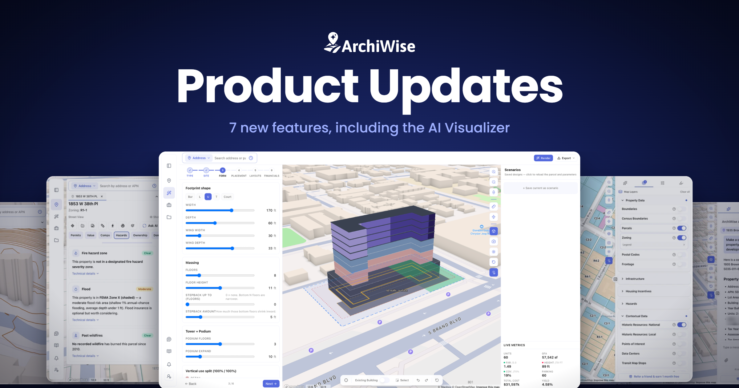

This release covers a lot of ground: a new guided way to design and test a project on the parcel, clearer hazard and zoning data, a sharper map, and a much smarter in-app chat.
Here’s everything that’s new, and why it matters.
1. AI Visualizer
Design and test a project on the parcel, step by step.
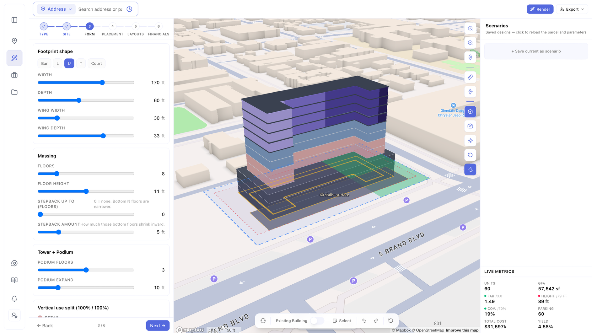
The new AI Visualizer walks you from concept all the way to numbers. Pick the building type, fit it to the site, shape the form, set its placement, generate layouts, and run the financials – all in 3D on the real lot.
Turn on AI rendering to see your plan come to life more realistically, then save everything as a report.
Why this matters:
You can explore what a site can actually become – massing, layout, financial feasibility, and a realistic rendered view – in one guided flow, and save it all as a shareable report. No leaving ArchiWise, no juggling separate tools.
2. Sharper Topography, Tighter Contour Lines
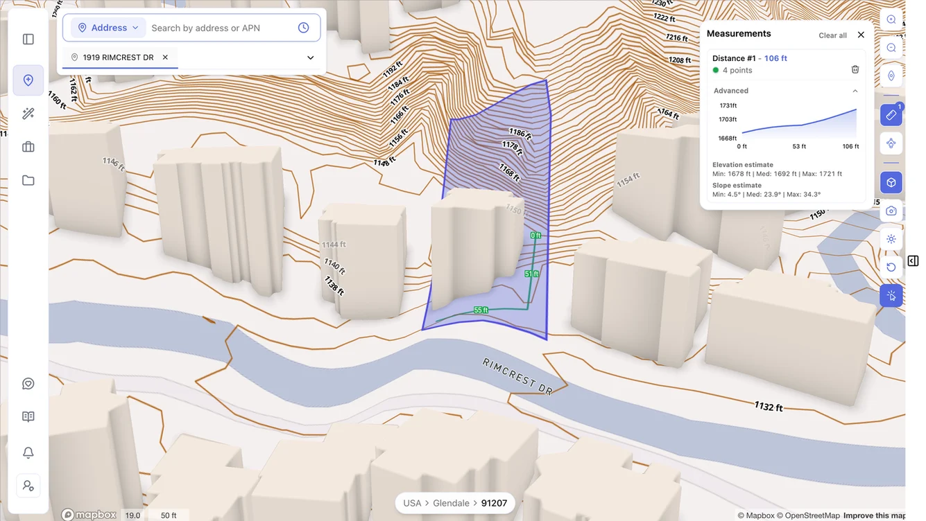
We’ve added detailed 10-foot and 2-foot contour sets that appear as you zoom to a parcel or a single lot. You can now see the slope and shape of the ground, not just the big hills.
Why this matters:
Grading, drainage and walkout-basement decisions all depend on real topography. Now the detail is there exactly when you need it.
3. Redesigned Hazards Tab
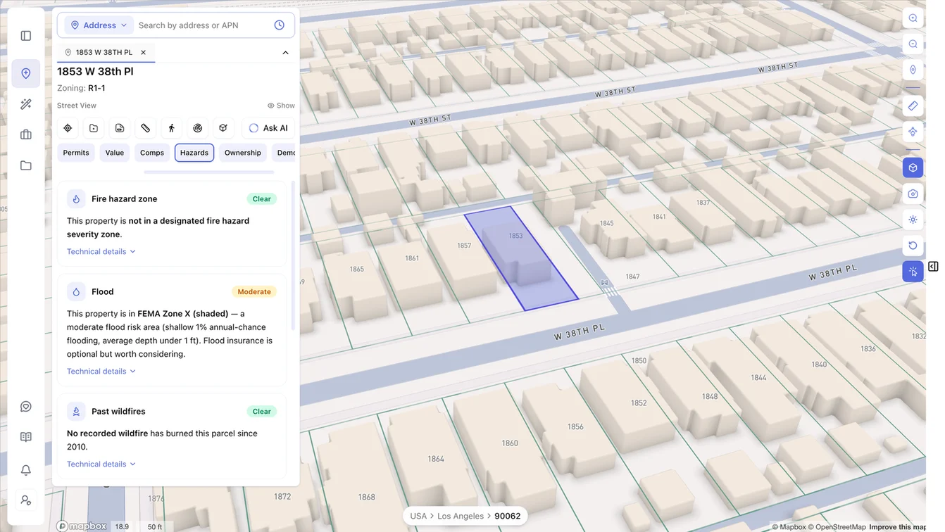
The Hazards tab now covers fire, flood, past wildfires, earthquake faults, seismic shaking and methane – each as a simple card with a clear status (Clear / Moderate / High) and a one-line explanation. No more raw codes or jargon.
Why this matters:
You can tell in seconds whether a site has a red flag, without decoding zone codes or FIRM IDs.
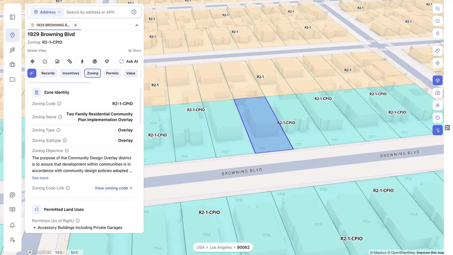
4. Clearer Zoning Tab
The Zoning tab is easier to read – helpful tooltips on every field, consistent formatting, and cleaner handling of long text.
Why this matters:
Less time understanding the data, more time deciding what to do with it.
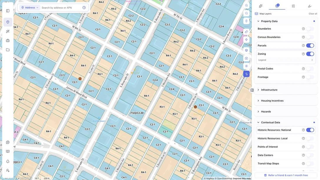
5. Cleaner Map Layering and Boundary Navigation
Overlays no longer hide what’s underneath. Parcel and boundary lines stay visible even with incentive overlays like DDA and QCT turned on, and moving between boundaries is smoother with an improved breadcrumb and border experience.
Why this matters:
The map stays readable no matter how many layers you turn on.
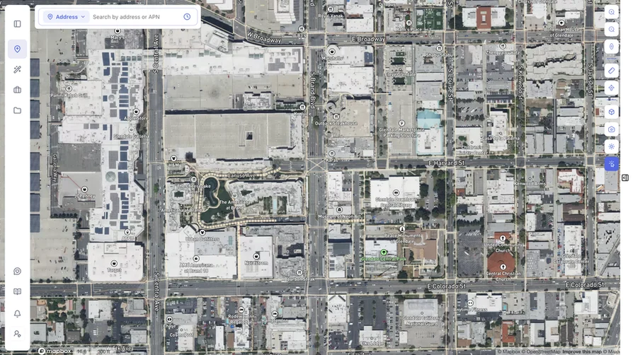
6. Hybrid Basemap
Satellite imagery now comes with street labels. The new hybrid basemap gives you real aerial context while still telling you exactly what you’re looking at.
Why this matters:
The best of both – true imagery and clear orientation, in one view.
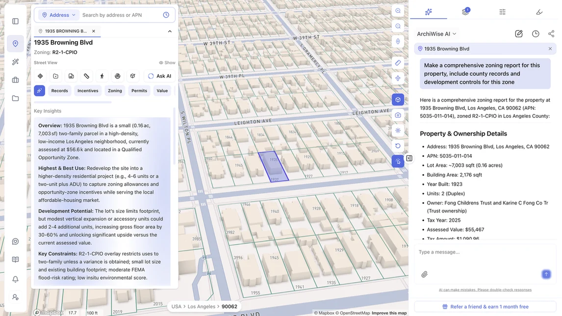
7. A Smarter Chat, Your In-App ArchiWise Guide
The chat is sharper and far more helpful. Think of it as your ArchiWise product owner sitting inside the app: it helps you navigate the platform and supports you across zoning, site selection and everything in between. We’ve also cleaned up how answers are delivered and shortened response times.
Why this matters:
Whether you’re brand new or deep in a workflow, there’s always something to point you to the right tool and give you the answer.
What This Means for You
This release moves ArchiWise further along the process. You could already decide whether a site was worth pursuing. Now you can go a step further and see what it could become – massing, layouts and feasibility, on the actual lot.
- Test a project on the parcel instead of imagining it
- Read hazard risk at a glance, without decoding anything
- See real ground conditions when you zoom in
- Keep the map legible with every layer you need turned on
- Get answers inside the app, faster
What’s Next
We’re shipping new updates regularly. More is on the way.
ArchiWise helps developers, investors, architects and brokers move beyond zoning theory and into parcel-level reality. Whether you’re evaluating land for housing, commercial projects or infrastructure like data centers, ArchiWise provides decision-ready intelligence before time and capital are committed.