

The bottleneck in real estate development has never been decision-making – it’s been everything that comes before it. Finding sites, understanding what can be built, running down zoning codes, calling utility companies, pulling ownership records, screening incentives, checking hazards – each step is manual, slow, and fragmented across a dozen different systems. Developers don’t spend a week on pre-application research because they’re inefficient. They spend a week because that’s how long it takes.
A new category of AI-powered real estate platforms changes that – putting zoning, ownership, infrastructure, incentives, and hazard data in one place, for any parcel, in seconds. The best of them don’t just surface data: they reason through it, cite their sources, and deliver answers a developer can act on. What separates a strong platform from a basic lookup tool: nationwide coverage so the same workflow applies in every market; document grounding so answers come from the actual planning codes governing that parcel; incentive and hazard screening built in; and professional-grade outputs ready for a presentation or permit submission without extra formatting work.
Archiwise is one of the most comprehensive platforms available today – built specifically for pre-development site analysis, covering every parcel in the United States, and grounded in thousands of planning documents across cities, counties, and states. Here are ten specific ways it compresses what used to take days of manual research into minutes.
1. Site Selection – Finding Sites Without a Known Address
The old way: Traditional site research required a known address. A developer would compile a list of potential addresses from brokers, listings, or local knowledge, then evaluate each one individually. Finding off-market opportunities meant manual canvassing, relationships, or luck.
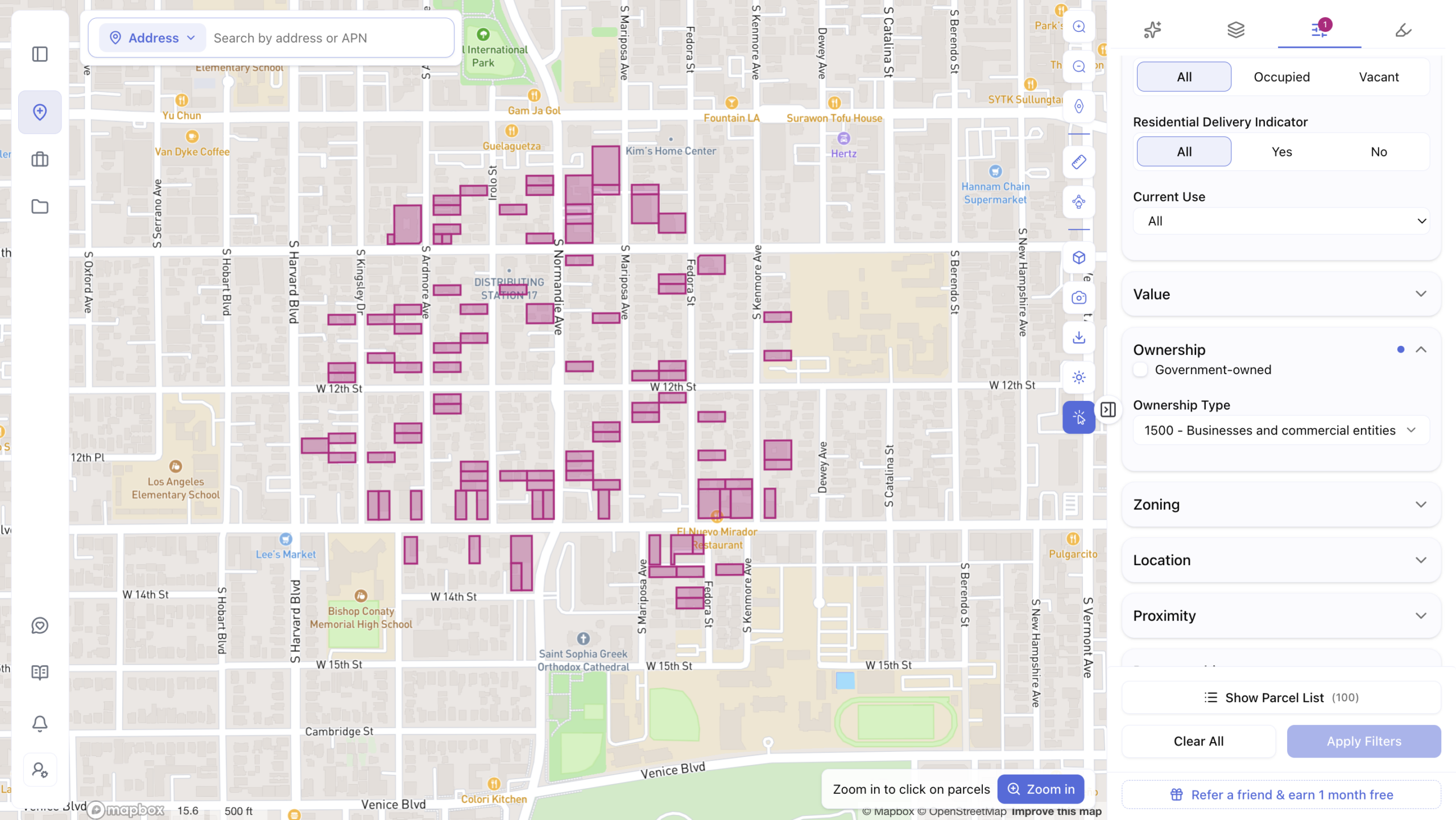
With Archiwise: The Draw Search Area tool lets a developer draw a polygon on the map and filter every parcel inside it by lot size, year built, zoning, location, vacancy status, current use, last sale price, ownership type,proximity and demographics – without knowing a single address in advance. Ownership type filters allow targeting by government-owned parcels or business and commercial entities specifically – a powerful lever for identifying institutional sellers or underutilized commercial land. Viewport filtration shows every parcel currently on screen. Zip or city filtration targets a municipality instantly. The results populate as a list that can be exported as a CSV or added directly to a project. The address-first constraint – which previously defined the entire site sourcing process – is gone.
2. Instant Zoning Analysis – What Can I Build Here?
The old way: A developer evaluating a new site would need to identify the zoning designation, look up the applicable code section, find the height district or overlay conditions, calculate density based on lot size and the applicable formula, and cross-reference any conditional use requirements. For a site with stacked conditions – a [Q] condition, a specific plan, and a state density bonus – this could take a full day of code reading.
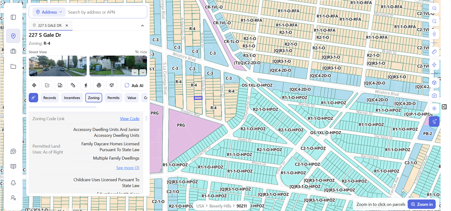
With Archiwise: The dedicated Zoning layer shows every parcel on the map color-coded by district the moment you toggle it on – residential, commercial, industrial, and every overlay, across an entire neighborhood at once. Before clicking a single address, a developer already sees the full zoning picture of the area.
Click any parcel and the info modal opens instantly with nine tabs of data: Records, Incentives, Zoning, Permits, Value, Comps, Hazards, Ownership, and Demographics – everything a developer needs for a complete site picture in one view. The Zoning tab alone surfaces the zoning code, zoning name, permitted uses as of right, conditional uses, prohibited uses, FAR, height limits, setbacks, lot coverage, density, parking requirements, and a direct link to the applicable code. No separate lookup, no county portal, no code PDF – it’s all there the moment you click.
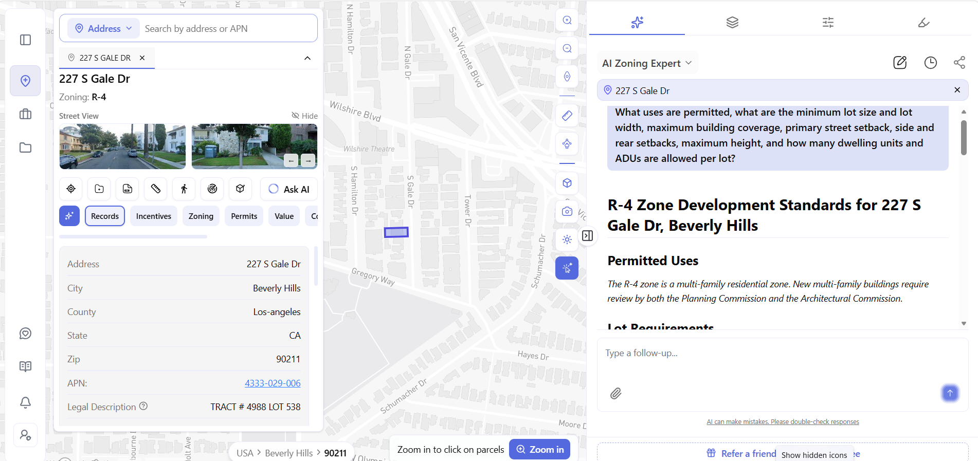
Need more than the tab shows? Ask the AI Zoning Expert directly – it will pull minimum lot size, setbacks, height limits, and maximum unit count for that exact parcel, with every figure cited to the code section it came from.
3. Infrastructure Screening – Without Calling Utility Companies
The old way: To find out whether a gas pipeline, electricity transmission line, or sewer line runs near a potential site, a developer had to call each utility company separately – the gas company, the electric utility, the water and sanitation department – and wait for responses. Each call involved a different process, a different timeline, and a different data format. The information typically arrived days or weeks into due diligence.
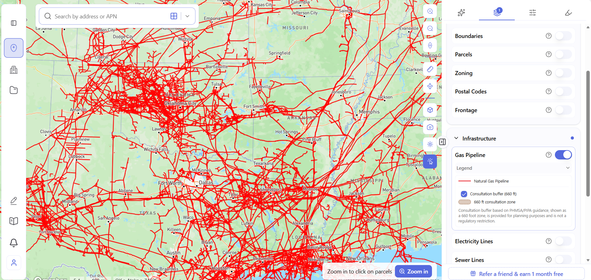
With Archiwise: Toggle on the Gas Pipeline layer and the full national pipeline network appears on the map as red lines, with a 660-foot PHMSA/PIPA consultation zone shown as a shaded buffer. Toggle on Electricity Lines and the power grid appears color-coded by voltage – from blue (< 100 kV) to pink (≥ 735 kV) – with right-of-way widths and consultation buffers shown in the legend. Toggle on Sewer Lines (currently available for Los Angeles) and the wastewater network appears instantly. Days of utility coordination compressed to seconds, before any commitment has been made. 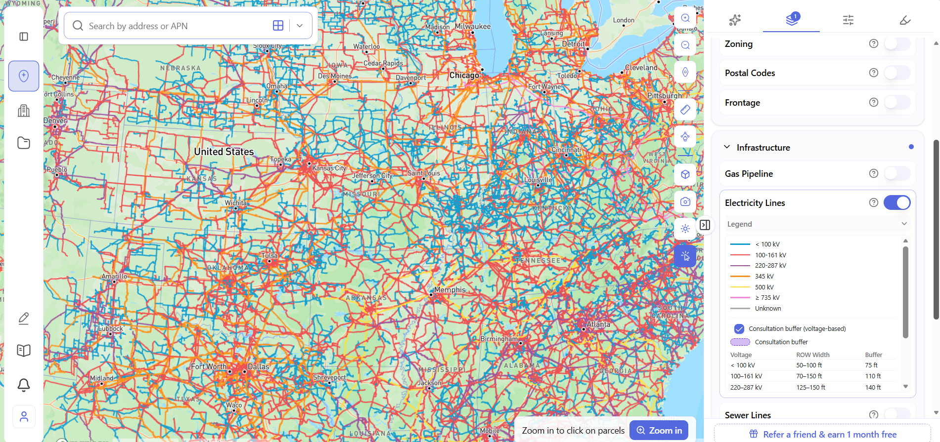
4. Incentive Eligibility Screening Across All Programs
The old way: Determining whether a site qualified for TOC, QCT, DDA, SB 9, SB 35, SB 79, or AB 2011 required checking each program separately – different eligibility criteria, different maps, different databases, sometimes different agencies. A developer trying to understand the full incentive picture for a single site could spend hours checking programs one by one.
With Archiwise: The Incentives tab screens every parcel automatically against all applicable programs – TOC tier, QCT status, DDA designation, SB 9, SB 35, SB 79, AB 2011 eligibility, and nearby LIHTC precedents – and surfaces them the moment a parcel is clicked. The AI Zoning Expert can then answer how stacking multiple incentives affects the total unit count for that specific site. Hours of program-by-program research replaced by a single click. 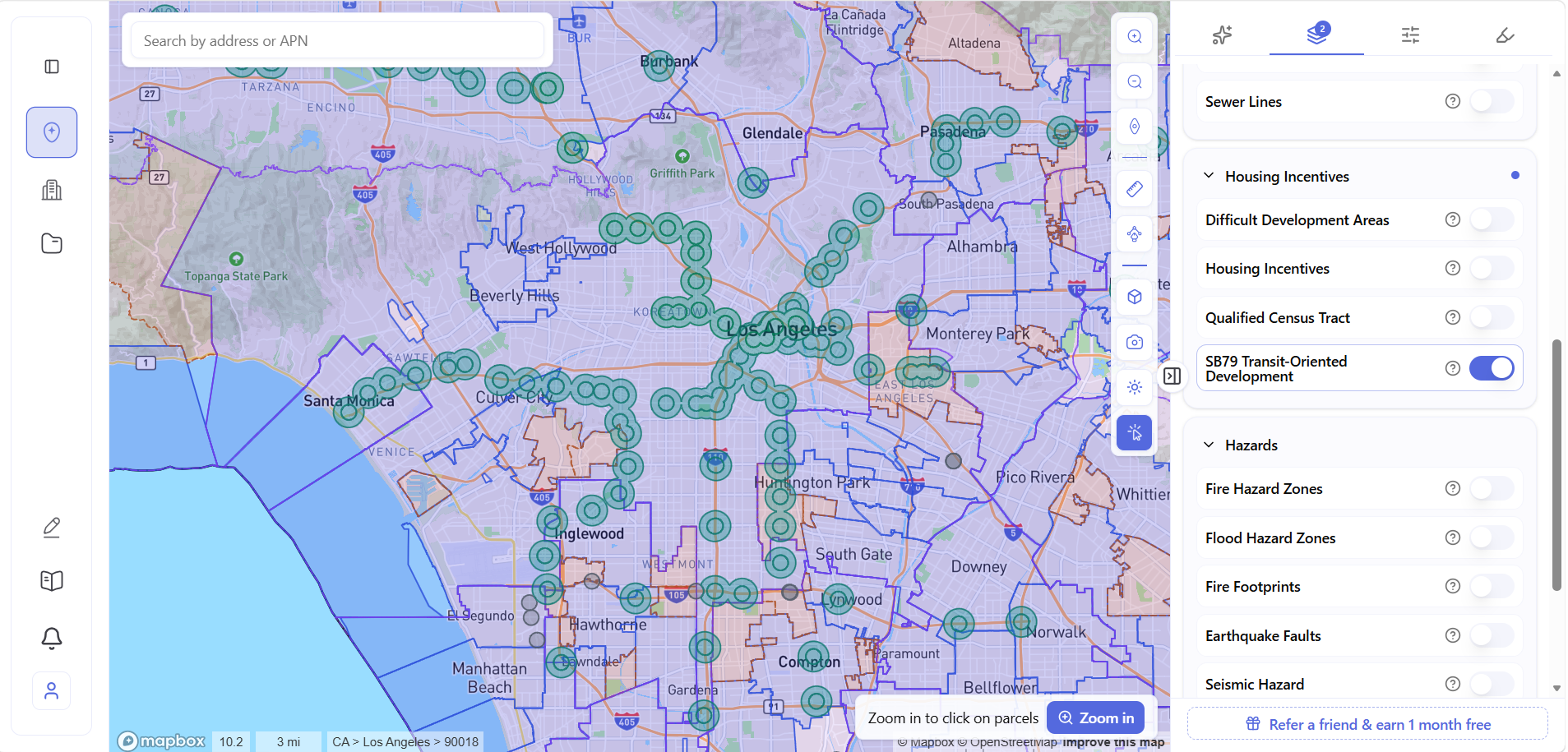
5. Hazard Exposure – Visible Before Due Diligence Begins
The old way: Assessing a site’s hazard exposure meant checking seismic data, fire hazard severity zones, flood maps, and methane risk through separate agency portals – FEMA for flood, CalFire for fire, USGS for seismic, local agencies for methane. Each had its own interface, its own data format, and no way to see how hazards intersected on a single parcel.
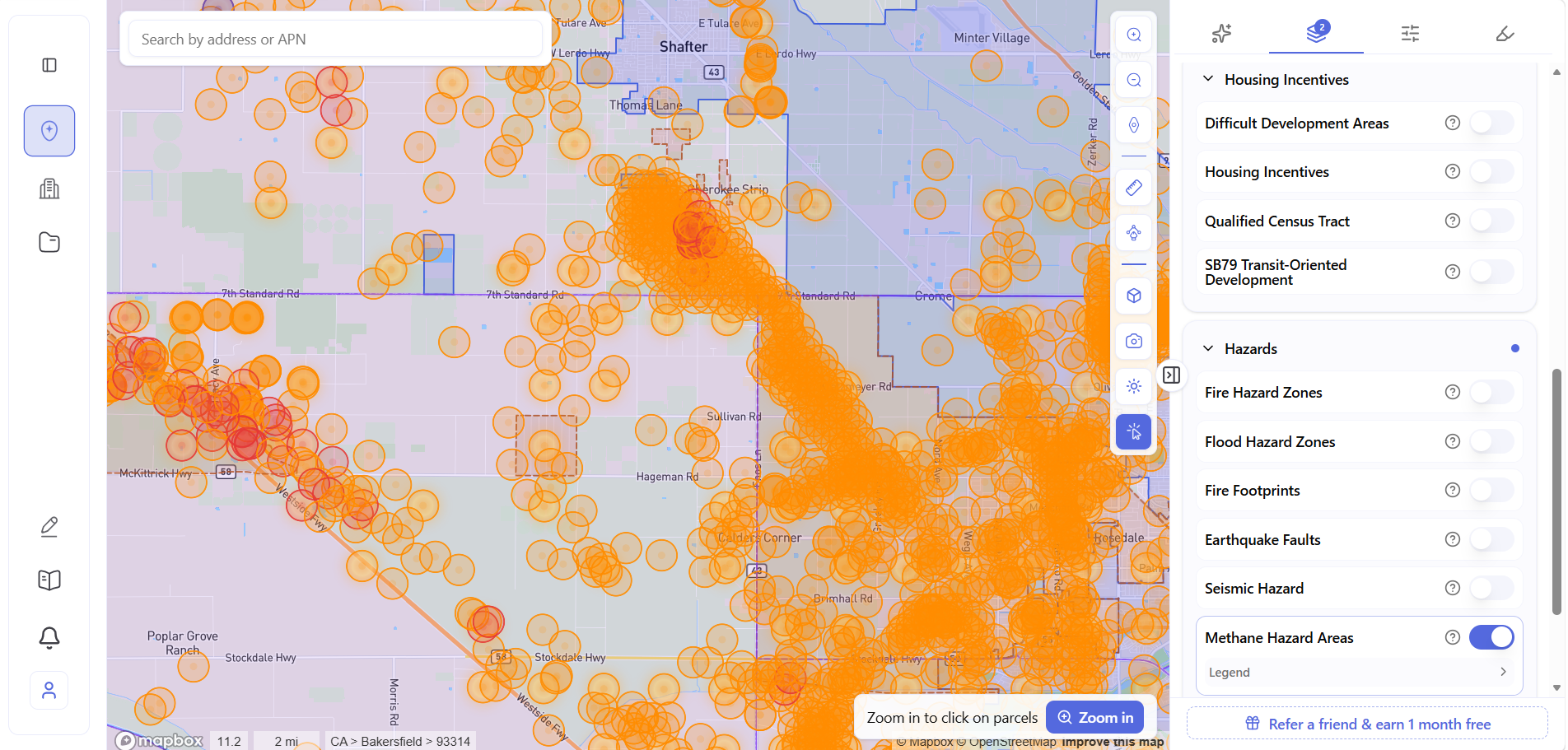
With Archiwise: The Hazards tab surfaces seismic rating, fault proximity, flood zone, fire hazard severity, methane risk, and fire footprints the moment a parcel is clicked – all in one place. Map layers for Fire Hazard Zones, Flood Hazard Zones, Earthquake Faults, Seismic Hazard, Fire Footprints, and Methane Hazard Areas can be toggled on to see how risks distribute across an entire corridor. Hours of cross-agency research, done before any professional fees begin.
 6. Radius Map Compliance Packages – in Under 2 Minutes
The old way: Before a developer can receive approval for a conditional use permit, variance, or zone change, they are legally required to notify every property owner within a set distance – typically 300 to 500 feet. Preparing that package manually meant pulling parcel data from the county assessor, cross-referencing the GIS database, drawing the radius, compiling the ownership list, and formatting the document to city specifications. Several hours of work, with real risk of errors that could delay a hearing.
With Archiwise: The workflow is simple: search any address or APN, open the Radius Map tool, select the distance your jurisdiction requires – 100, 300, 500, or 1,000 feet, or a custom value up to 2,000 feet – optionally customize the map colors, then click Generate. Archiwise draws the radius boundary on the map, highlights every parcel within range, and populates the full ownership list instantly. When ready, click Export PDF to produce the submission-ready compliance document.
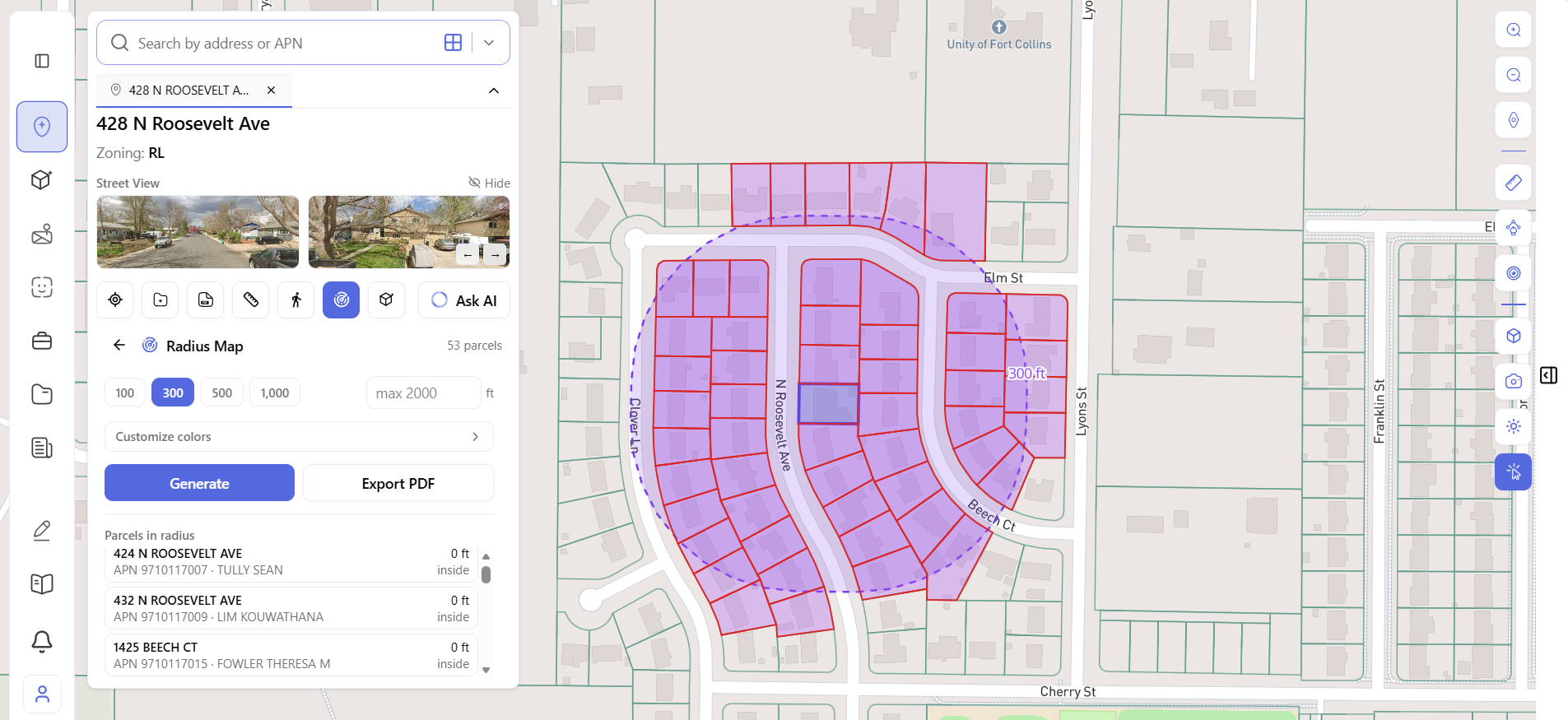
7. Ownership Data for Off-Market Outreach
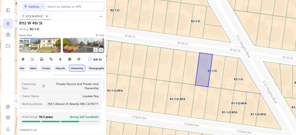
The old way: Finding out who owns a parcel – and more importantly, where to reach them – required accessing the county assessor’s database, which varies by county in terms of interface, update frequency, and what it actually shows. Many assessor portals don’t show mailing addresses in the public internet version. Getting the data in a usable format often required a paid data pull or a title company query.
With Archiwise: The Ownership tab shows the owner name, ownership type, and mailing address for any parcel in the US – including absentee owners whose mailing address differs from the site address. For a developer building an off-market outreach list, this is the data that makes direct mail campaigns possible without a separate title company engagement. A lookup that used to require a county portal or a paid pull is now part of the standard parcel view.
 8. Multi-Parcel Assemblage Analysis
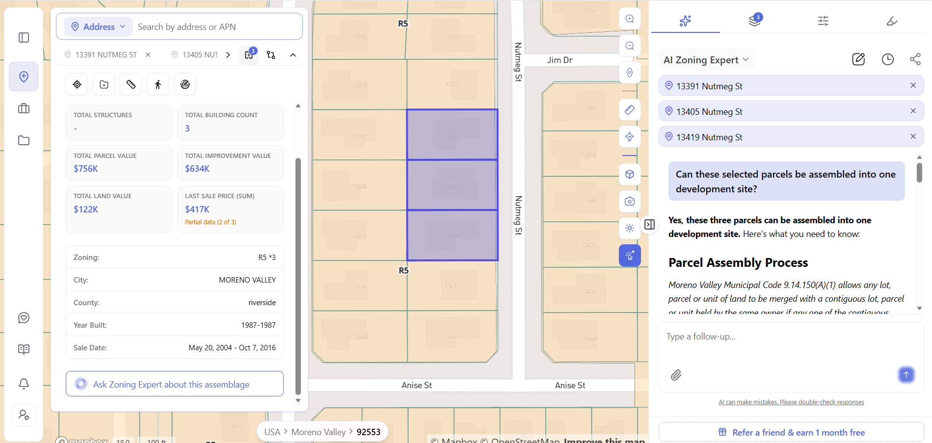
The old way: Evaluating whether two or three adjacent parcels could be combined for a larger project meant separately looking up each parcel’s zoning, size, ownership, and applicable development standards – then manually combining the numbers and reasoning through merger requirements, minimum lot dimensions, and what the combined site could support.
With Archiwise: Select up to five parcels simultaneously and the platform shows combined lot area, total assessed value, total improvement value, and a land-versus-improvement breakdown for the full assemblage. Ask the AI Zoning Expert about the combined site – whether multifamily is permitted by right, what the merger requirements are, what constraints could affect the project – and get a cited answer covering all selected parcels together. Manual multi-parcel math replaced by instant combined analysis.
9. Nationwide Coverage – One Tool for Every Market
The old way: A developer working across multiple cities or states needed different tools for different markets. ZIMAS for Los Angeles. The county assessor portal for other California cities. A different GIS system for Colorado, Texas, or Illinois. A different consultant for each jurisdiction. Each tool had different interfaces, different data fields, and different update cycles.
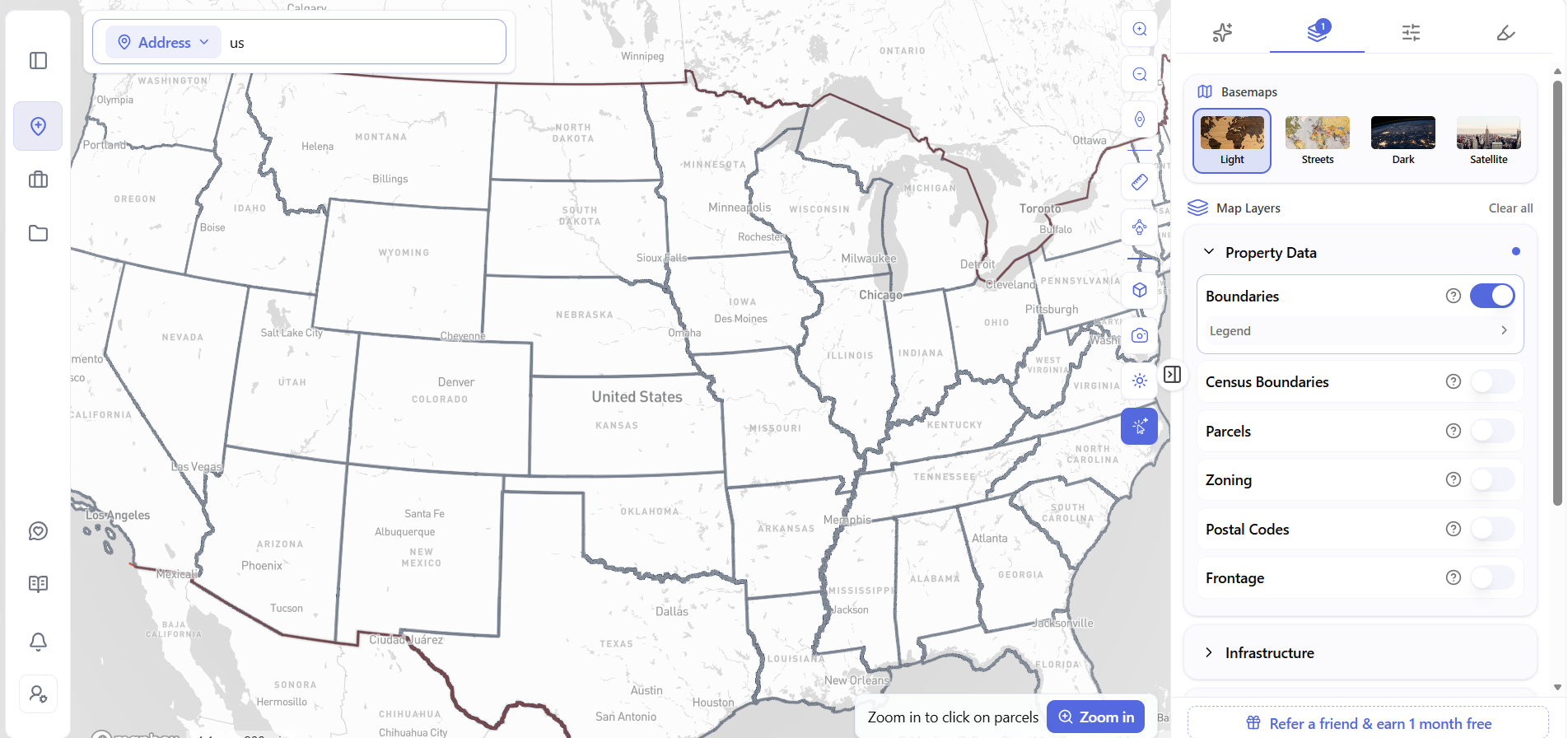
With Archiwise: The same interface works for any parcel in the United States – same AI Zoning Expert, same tabs, same layers, same export format. A developer screening sites across different cities uses the same workflow for all of them. The AI draws from planning documents for the specific jurisdiction of each parcel, so the answer for a site in one city is as cited and specific as the answer for a site in another. The tool-switching and consultant-per-market overhead is gone entirely.
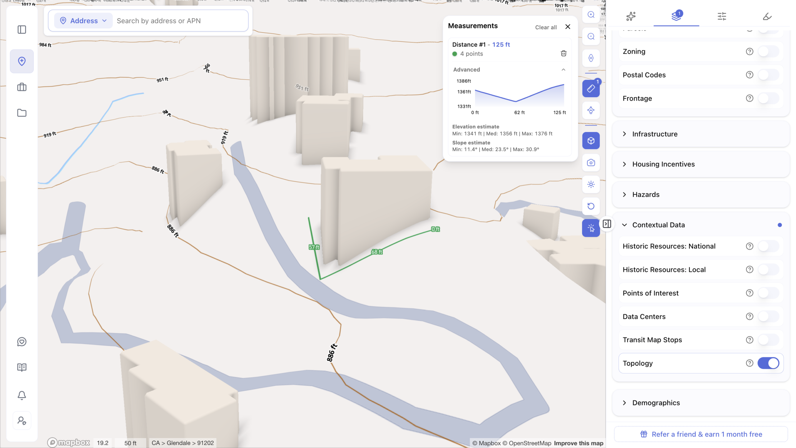
10. Measure Elevation & Slope in 3D
The old way: Understanding a site’s buildability from a topography standpoint meant pulling USGS contour data or a survey, then manually calculating elevation change and slope between points — often with CAD software or a hired surveyor — before a developer could even estimate grading costs or know whether a hillside ordinance might apply. That analysis typically didn’t happen until well after a site was already under serious consideration, since it required a dedicated tool and someone who knew how to use it.
With Archiwise: The measurement tool now works directly in 3D, letting a developer measure elevation differences and calculate land slope between points on the actual terrain — right alongside the zoning and hazard data for the same parcel. Drop points along a path and get distance broken into segments, plus min, median, and max readings for both elevation and slope. Better understanding of site topography, before design and feasibility analysis begin, replaces what used to require a separate survey or CAD workflow.
The Common Thread
Every one of these ten tasks shares the same structure: data that exists, scattered across multiple systems, requiring manual effort to assemble, arriving too late to influence the earliest and most consequential decisions in a deal.
Archiwise closes that gap by putting every layer in one place, grounded in the actual planning documents for that parcel and ready the moment a site comes up. What used to take a week of phone calls and county portals now takes minutes, on any parcel in the country.
The developers who move fastest aren’t working harder than everyone else. They’re starting from a better-informed starting point.
Learn more
ArchiWise helps developers, investors, architects, and brokers go from address to decision in minutes, not weeks.
Whether you’re screening sites for multifamily development, evaluating zoning constraints, surfacing incentive eligibility like QCT and LIHTC, or assessing hazard risk before committing capital, ArchiWise runs every layer of analysis in one place.
Explore how ArchiWise helps teams screen development sites, analyze zoning, and make confident go/no-go decisions faster.