

Picture this. You spend three weeks digging into a site. You check the zoning. You call the city planner. You wait for a callback that never comes. Then, in week four, you learn the site has an overlay restriction that kills the deal.
This happens more often than most developers admit. Money and time get spent before anyone knows if a site even works. The real damage isn’t the deal that fails. It’s the weeks lost finding out.
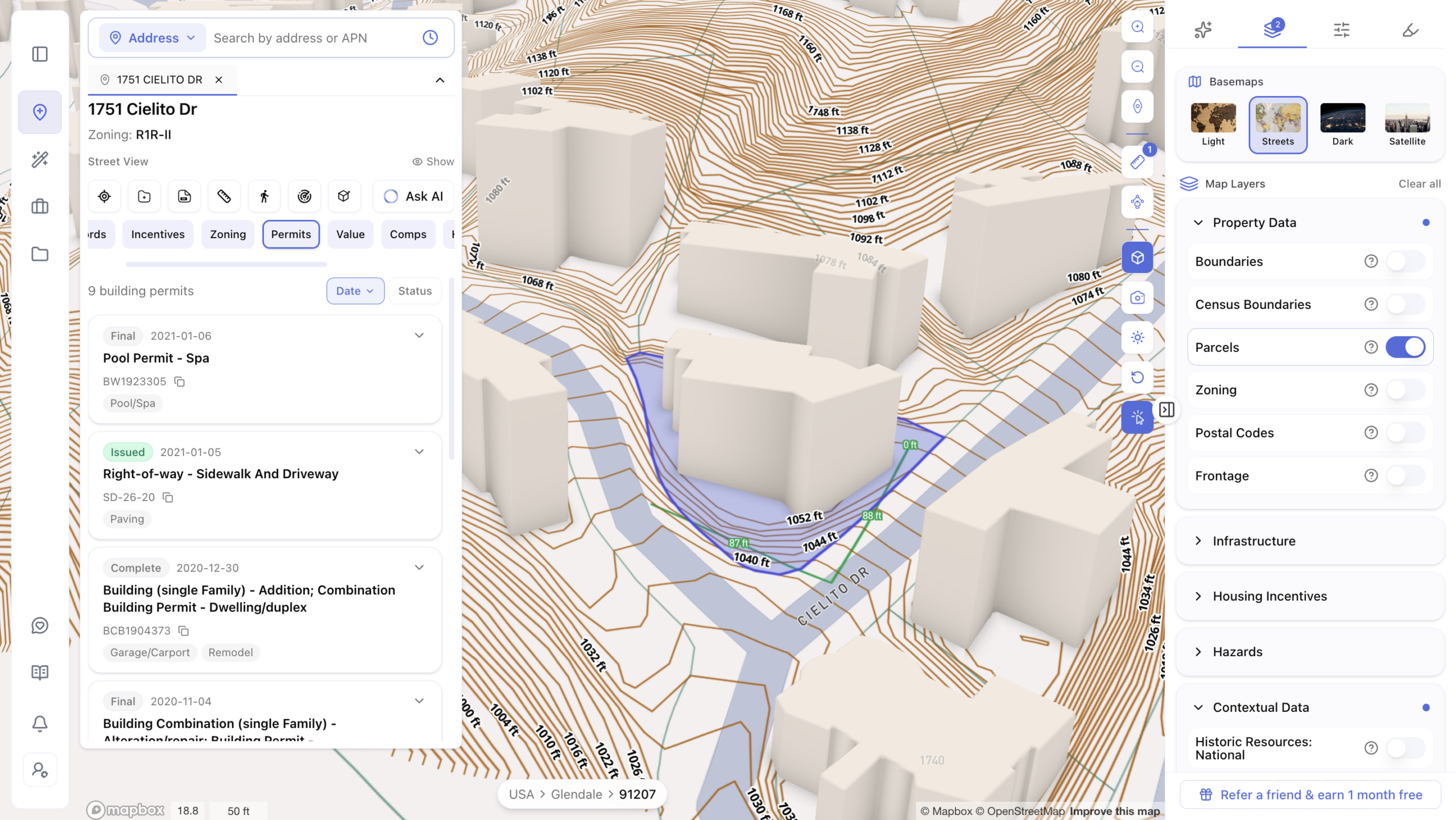
This is why a new kind of tool is changing how developers, investors, and architects work: the nationwide parcel intelligence platform. Instead of digging through scattered city websites and PDFs, these platforms pull zoning, parcel, and land use data into one place. This is quickly becoming the new normal for real estate development, not just a nice extra.
Why Site Selection Is Where Deals Are Actually Won or Lost
Here’s something most developers don’t think about enough: the sites listed on MLS or LoopNet are only a small slice of what’s out there. Many of the best opportunities never get listed at all. They sit quietly as underused lots where zoning allows far more than what’s currently built.
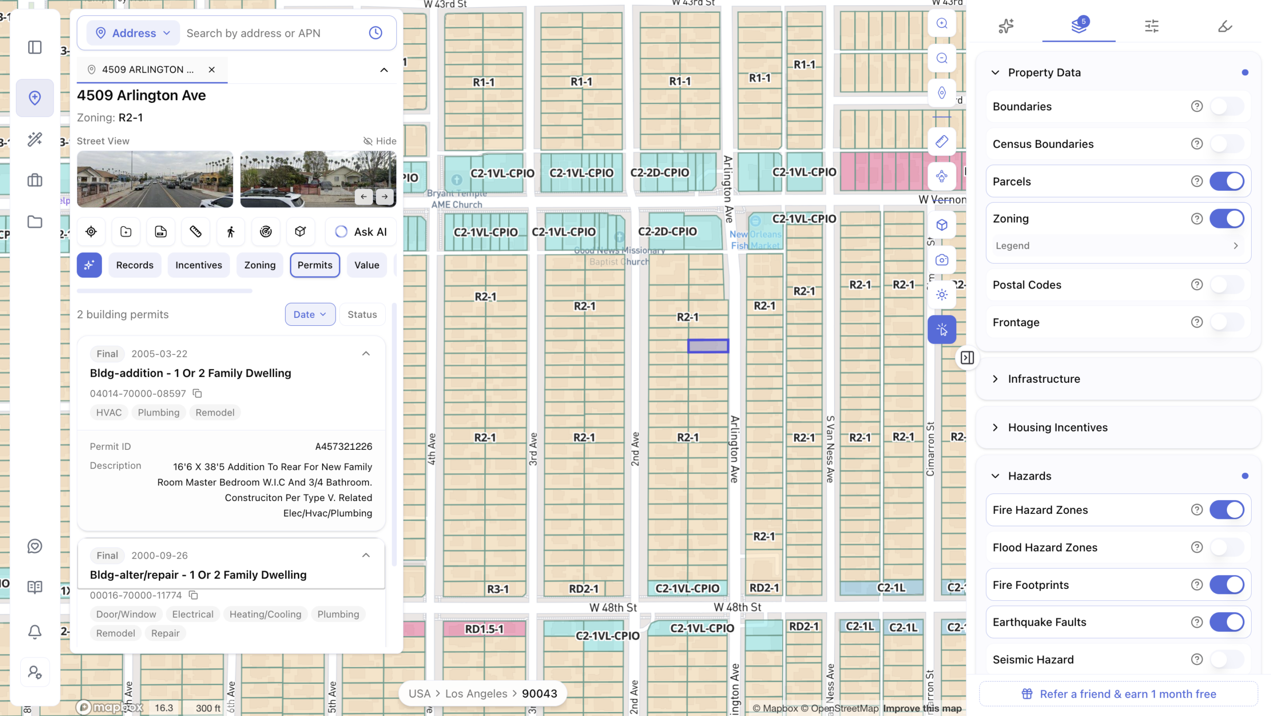
Finding these hidden opportunities takes real digging. You have to check zoning maps, read code sections, and compare what’s allowed against what’s already there. Do this by hand, and you can only check a handful of sites at a time. Someone using a faster process is already three steps ahead of you.
This is the real cost of manual site selection. It’s not just slow. It means you’re seeing less of the market than your competitor is. Often, the best deals are sites where zoning quietly allows far more than the current use is worth. You can only find them if you’re looking the right way.
How AI Changes the Mechanics of Site Selection
AI tools don’t replace a developer’s judgment. What they do is speed up the research that used to eat weeks of every deal cycle. Here’s how.
Screening at scale. Instead of checking one parcel at a time, AI tools let you search using plain language. You can look for lots zoned a certain way, in a certain area, with certain ownership patterns, all at once. What used to take days now takes minutes.
Zoning and FAR analysis in minutes. One term you’ll hear often is FAR, or Floor Area Ratio: the ratio between a building’s total floor space and the size of its lot. A higher FAR means more square footage on the same land. AI tools can also check setbacks (how far a building must sit from property lines), overlay districts (extra rules layered on top of standard zoning), and density bonus programs (special rules allowing more units under certain conditions). Checking all of this by hand across city code books can take days. AI can surface it in minutes.
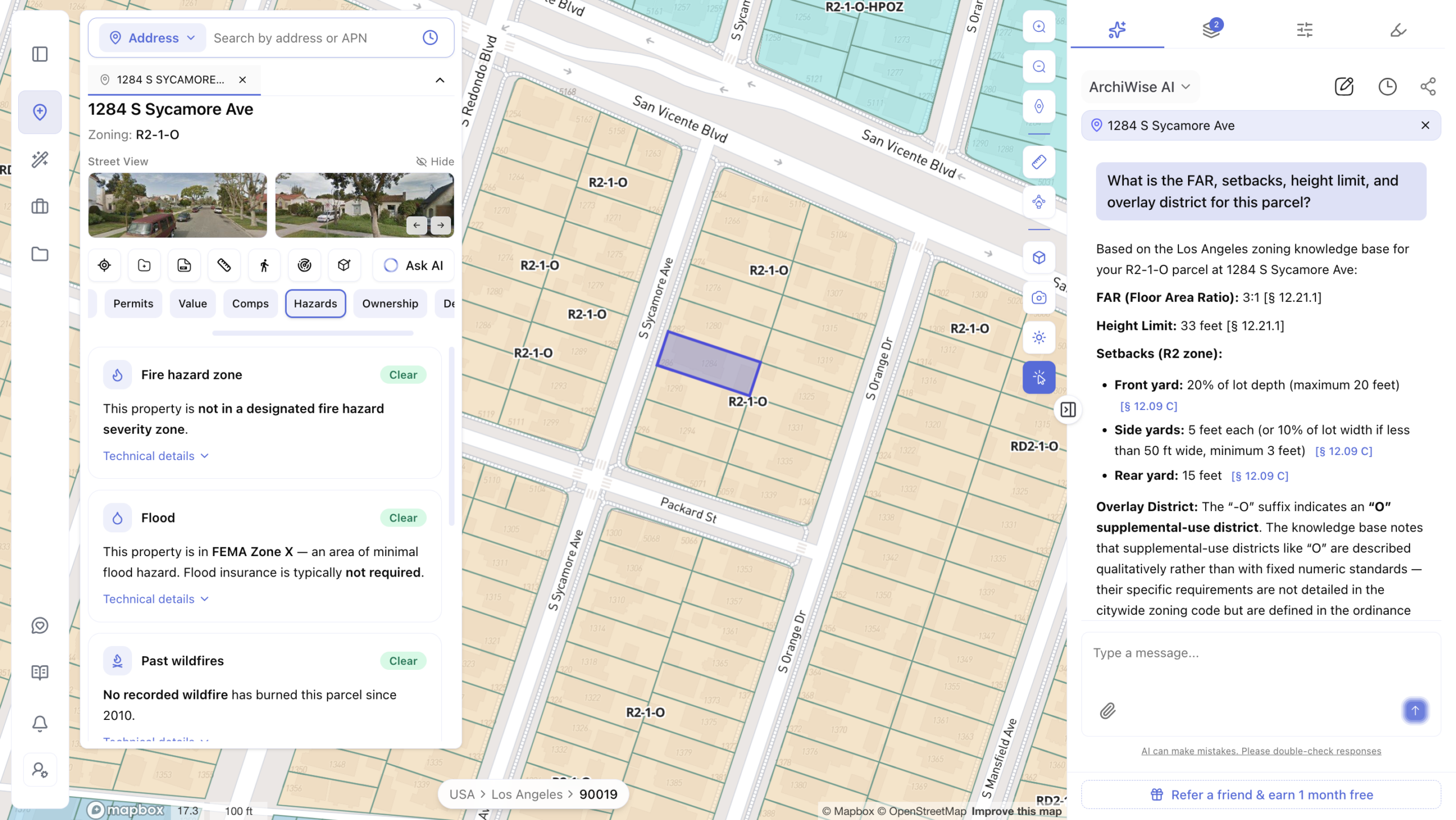
Off-market discovery. Perhaps the biggest advantage is finding sites that never hit the open market. AI can scan entire markets and flag lots where the current use, like a single small home, sits on land zoned for much larger multifamily development. These are the sites brokers haven’t called about yet, and where the best deals often are.
Inside an AI Site Selection Workflow: A Practical Walkthrough
Here’s how this looks in practice, using a real case ArchiWise has shared. A developer was looking at a single-family lot listed at $1.8 million. On paper, it looked like a modest listing.
ArchiWise checked it against five questions that shape every development decision:
- Where should we build? The lot sat in a growing area with strong demand.
- What can we build there? The zoning allowed more than what was currently built.
- Is this a good place to build? Nearby transit and planned infrastructure supported new density.
- Does it pencil? A quick pro forma showed the numbers worked.
- Will the city approve it? Similar projects nearby had a strong track record of approval.
Along the way, the platform flagged a rarely used density bonus program the listing never mentioned. What looked like a 24-unit site on paper could actually support 32. That single discovery turned a marginal deal into a strong one. This is the real value of a platform like this: it doesn’t just describe what’s listed. It shows what’s actually possible.
Where ArchiWise Fits In
This is exactly the gap ArchiWise was built to close. ArchiWise is an AI decision platform built for the pre-development stage of real estate, the research and planning work that happens before a shovel ever hits the ground.
The platform covers over 3,000 counties and over 19,000 cities across all 50 states. That’s a level of reach very few tools in this space can match. Instead of jumping between municipal code sites, zoning maps, and PDFs, ArchiWise brings all of it into one place.
Its AI Site Selection tool is built specifically for the challenge we just walked through. It lets you search using plain language, rank sites by opportunity, and surface off-market parcels other buyers haven’t found yet. One developer using the platform said they cut their due diligence timeline from six weeks down to just eight days. That’s the kind of speed that lets a team make a strong offer while competitors are still waiting on a zoning report.
ArchiWise offers plans built for different needs, from simple self-serve options for individuals to full enterprise plans for larger teams handling many projects a year. Pricing details and current plan options are always available on the ArchiWise pricing page.
ArchiWise vs. the Alternatives
If you’ve researched this space, you’ve likely come across a few other names. Here’s how they compare, in plain terms.
ArchiWise vs Zoneomics. Zoneomics is mainly a zoning data provider. It’s the data layer behind tools like TestFit and Autodesk Forma. ArchiWise, by contrast, is a full workflow, taking you from finding a site all the way through to understanding your approval odds.
ArchiWise vs Symbium. Symbium focuses on checking what you’re allowed to build at a specific address, useful for permitting. ArchiWise starts earlier, helping you find and evaluate sites before you’ve committed to one.
ArchiWise vs TestFit. TestFit is a design tool. It helps you generate building layouts once you already have a site in mind. ArchiWise helps you decide which sites are even worth designing for in the first place.
ArchiWise vs Prophetic. Prophetic has built third-party zoning data (from Zoneomics) into its own AI platform, including a confirmed integration supporting D.R. Horton’s use of AI-assisted zoning analysis. ArchiWise’s edge is its full five-step framework, covering the entire decision process rather than zoning data alone.
Each of these tools solves a piece of the puzzle. ArchiWise’s goal is to bring the full picture together in one place.
What to Look for When Evaluating an AI Site Selection Tool
If you’re comparing tools for your own team, a few questions can help you cut through the marketing.
- How fresh is the data, and where does it come from? Data pulled straight from official city and county sources beats data scraped from older records.
- Does it cover the whole process, or just one piece? Some tools only handle zoning lookups. Others, like ArchiWise, cover site selection, zoning, feasibility, and approval odds together.
- Can it find off-market sites, or only listed ones? This is often the real difference between a good tool and a great one.
- Is the pricing clear? Look for straightforward plans instead of vague, sales-call-only pricing.
Asking these questions before you commit to a platform can save you both money and headaches later.
The Bigger Picture
It’s worth noting that this shift isn’t happening in isolation. The Urban Land Institute and PwC’s 2026 Emerging Trends in Real Estate report, one of the industry’s most closely watched annual outlooks, named “AI Moves into Real Estate” as one of five defining trends shaping the industry this year. In other words, this isn’t a passing trend. It’s becoming part of how the industry works.
A nationwide parcel intelligence platform doesn’t replace a developer’s judgment. It gives that judgment more to work with. Instead of spending weeks finding out if a site is worth pursuing, you can know in days, and spend your capital on sites that actually deserve it.
Stop Guessing. Start Knowing.
Every week you spend manually researching a site is a week your competitor might spend closing one. The developers, investors, and architects winning the most deals right now aren’t smarter than everyone else. They just know faster.
Don’t let your next great deal slip away while you’re still waiting on a zoning report. See what ArchiWise can tell you about your next site, before you spend another dollar finding out the hard way.
Start your free trial today, or book a 30-minute demo and see exactly what your next site can become.
Learn more
ArchiWise helps developers, investors, architects, and brokers go from address to decision in minutes, not weeks.
Whether you’re screening sites for multifamily development, evaluating zoning constraints, surfacing incentive eligibility like QCT and LIHTC, or assessing hazard risk before committing capital, ArchiWise runs every layer of analysis in one place.
Explore how ArchiWise helps teams screen development sites, analyze zoning, and make confident go/no-go decisions faster.