
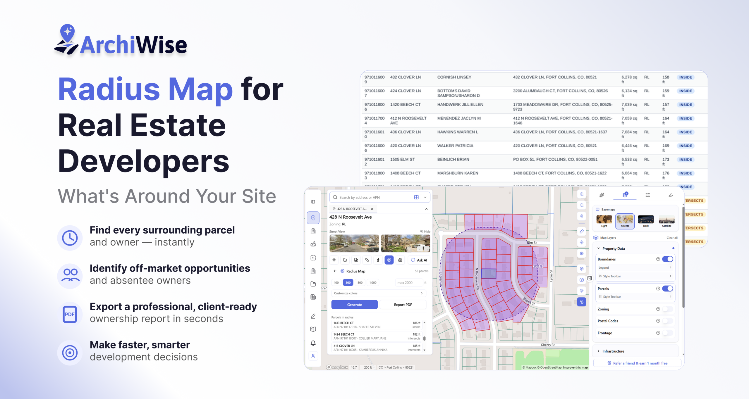

What’s Around Your Site – and Why It Could Make or Break Your Deal
Before a developer can receive approval for a planning permit – a conditional use permit, a variance, a zone change, or a development agreement , they are legally required to notify every property owner within a set distance of their site. That notification package – the radius map, the ownership list, the mailing labels – is a mandatory submission. Get it wrong, and the hearing gets delayed. Miss it entirely, and the project stops.
This is what a radius map is for. And this is what Archiwise generates in seconds.
The Legal Requirement Every Developer Has to Meet
In the United States, most local jurisdictions require developers to submit a radius map as part of planning applications that involve public notification – conditional use permits, variances, zone changes, and development agreements.
The requirement typically works like this:
- 300 feet – required for minor use permits, minor variances, and smaller permit types
- 500 feet – required for conditional use permits, design reviews, zone changes, and development agreements
- 660–1,000 feet – required for larger or more sensitive projects, depending on the jurisdiction
The radius map must show the subject property and every parcel that falls within that distance. Alongside it, the developer must submit a complete ownership list – the legal name and mailing address of every property owner within the radius, taken from the county assessor’s records – plus printed mailing labels addressed to each one.
These documents are not optional. They are a legal prerequisite. If the radius is drawn incorrectly, if owners are missing from the list, or if the submission doesn’t meet the city’s formatting requirements, the hearing can be postponed and the entire entitlement timeline pushed back.
This is why radius maps matter to developers. Not as a nice-to-have analysis tool – but as a required compliance deliverable that every project needs before it can move forward.
How This Used to Work – and Why It Was a Problem
Before purpose-built tools existed, preparing a radius map compliance package was a slow, manual process. A developer or their consultant would start with the county assessor’s records to pull ownership data, cross-reference a GIS database for parcel boundaries, draw the radius by hand or in a mapping application, compile the ownership list into a formatted spreadsheet, print mailing labels, and assemble the full package to the city’s exact specifications.
For a 300-foot radius in a dense neighborhood, that could mean manually identifying and verifying 40 to 60 individual property owners. In a 500-foot radius, the number climbs higher.
The process typically took several hours – sometimes a full day – and still required a second pass to check for errors. A missed owner, an outdated mailing address, or a radius drawn to the wrong boundary could trigger a rejection from the planning department and force the whole process to start again.
How Archiwise Generates the Compliance Package
Archiwise built its Radius Map feature to handle this exact requirement – producing a complete, accurate, professionally formatted radius map and ownership report in seconds, for any parcel in the United States.
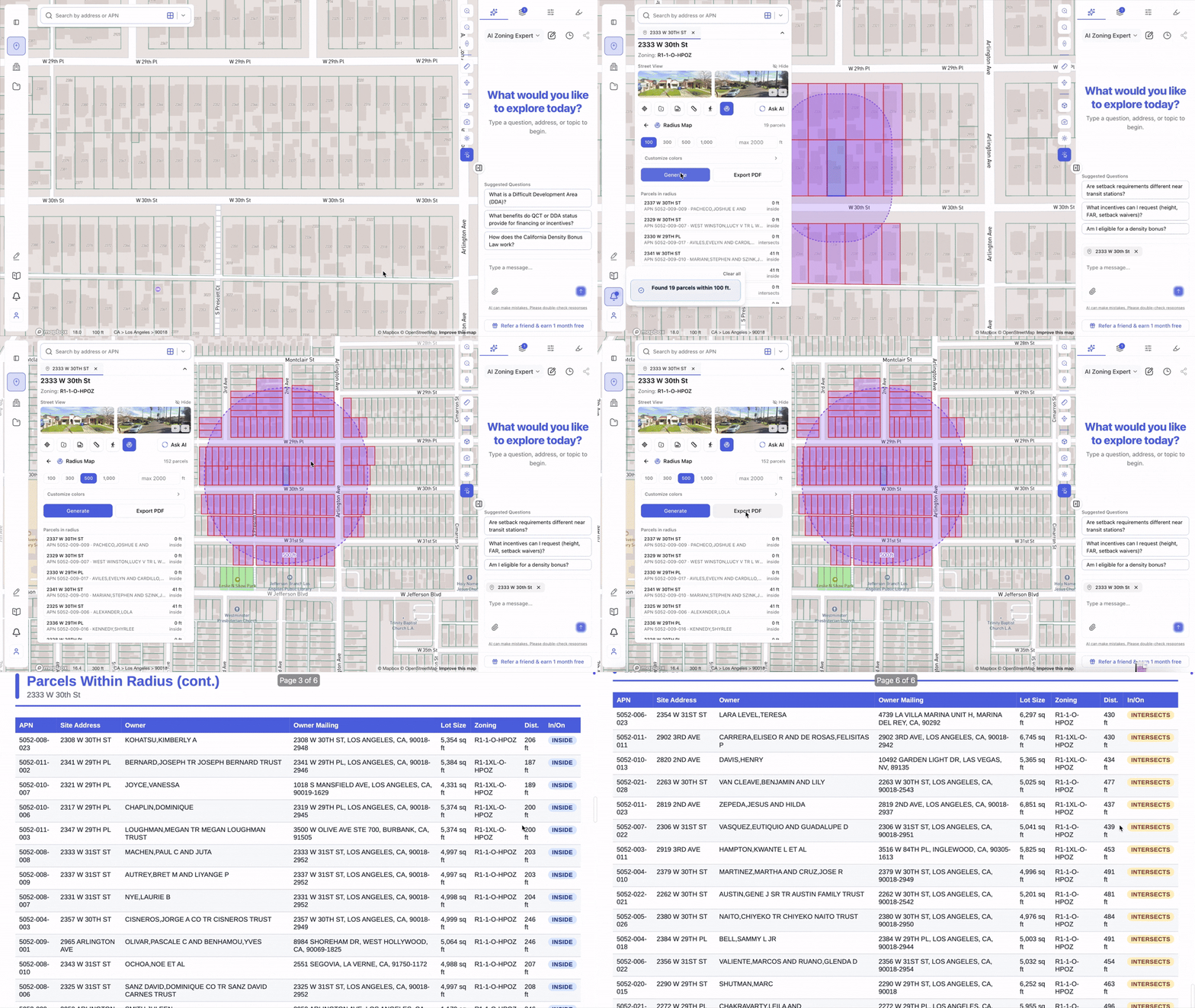
The workflow is simple: search any address or APN, open the Radius Map tool, select the distance your jurisdiction requires – 100, 300, 500, or 1,000 feet, or a custom value up to 2,000 feet – optionally customize the map colors, then click Generate. Archiwise draws the radius boundary on the map, highlights every parcel within range, and populates the full ownership list instantly. When ready, click Export PDF to produce the submission-ready compliance document.
Here is what the tool looks like after Generate is clicked – in this case at a 300-foot radius around 428 N Roosevelt Ave in Fort Collins, Colorado:
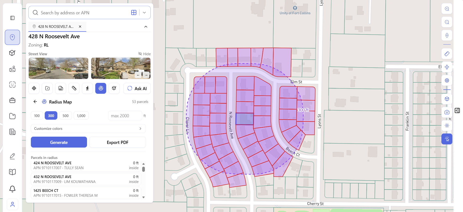
The parcel list on the left shows every property owner within the radius – name, APN, exact distance, and inside/intersects status – ready to verify before exporting. The map shows the radius visually, with every affected parcel highlighted. At 300 feet, 53 parcels are identified. The compliance package scales automatically with whichever distance the jurisdiction requires.
What the Exported Compliance Report Contains
Click Export PDF and Archiwise produces a complete, professionally formatted document ready to submit to the planning department.
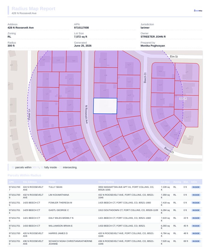
The report includes:
- Cover page – subject property metadata including address, APN, jurisdiction, zoning, lot size, owner of record, radius distance, generation date, and preparer name
- Map visual – the radius drawn to scale with all parcels color-coded by inside/intersects status
- Full ownership table – every parcel within the radius with APN, site address, legal owner name, owner mailing address, lot size, zoning, exact distance, and inside/intersects status
The ownership table is the core of the compliance submission. It is the data the planning department uses to verify that all affected neighbors have been identified, and it is the source for the mailing labels that go on the notification envelopes sent to each owner.
A Real Example: 428 N Roosevelt Ave, Fort Collins, CO
Here is what the compliance package looks like on an actual parcel.
The subject property is 428 N Roosevelt Ave – a 7,572 sq ft RL-zoned parcel in Fort Collins, Colorado, owned by STREETER JOHN R. With a 300-foot radius required for this type of application, clicking Generate in Archiwise immediately identifies 53 parcels – 32 fully inside the radius, 21 intersecting it.
The report is generated in seconds and includes the subject property’s full metadata, the color-coded map, and the complete ownership table for all 53 parcels – with legal owner names, mailing addresses, lot sizes, zoning, and exact distances, exactly as required for submission.
The same package assembled manually – pulling ownership data from Larimer County’s assessor records, verifying each entry, drawing the radius map, formatting the document to city specifications – would take several hours and introduce significant risk of error.
With Archiwise, the entire compliance package is ready in under two minutes.
Generate a compliant radius map and ownership report for any US parcel with Archiwise – in seconds, ready to submit.
Learn more
ArchiWise helps developers, investors, architects, and brokers go from address to decision in minutes, not weeks.
Whether you’re screening sites for multifamily development, evaluating zoning constraints, surfacing incentive eligibility like QCT and LIHTC, or assessing hazard risk before committing capital, ArchiWise runs every layer of analysis in one place.
Explore how ArchiWise helps teams screen development sites, analyze zoning, and make confident go/no-go decisions faster.