

Introduction
Every developer knows the feeling. You find a site. The zoning looks right. The price looks fair. The numbers seem to work.
Then, weeks later, something goes wrong. A flood zone nobody mentioned. A sewer line that can’t handle a new building. A neighborhood that isn’t growing the way you thought.
Zoning tells you what you can legally build. It does not tell you if the site is actually a good place to build. That gap is where good deals quietly turn into bad ones.
This is where Area Intelligence comes in. It looks past the zoning code and studies the forces that decide whether a location will actually succeed. Here’s what Area Intelligence is, and how it changes the way developers, investors, and architects choose sites.
The Problem: Site Selection Stops at “Is It Buildable?”
Site selection sounds simple. Find a parcel. Check the zoning. Decide if it’s worth pursuing.
But zoning only answers one question: what is legally allowed on this land? It might tell you the maximum number of units, or the Floor Area Ratio (FAR) – a simple number that compares a building’s total floor space to the size of its lot. That’s useful, but it stops there.
Zoning says nothing about flood risk. It says nothing about whether a neighborhood is growing or shrinking. It says nothing about whether the local sewer system can handle a new project.
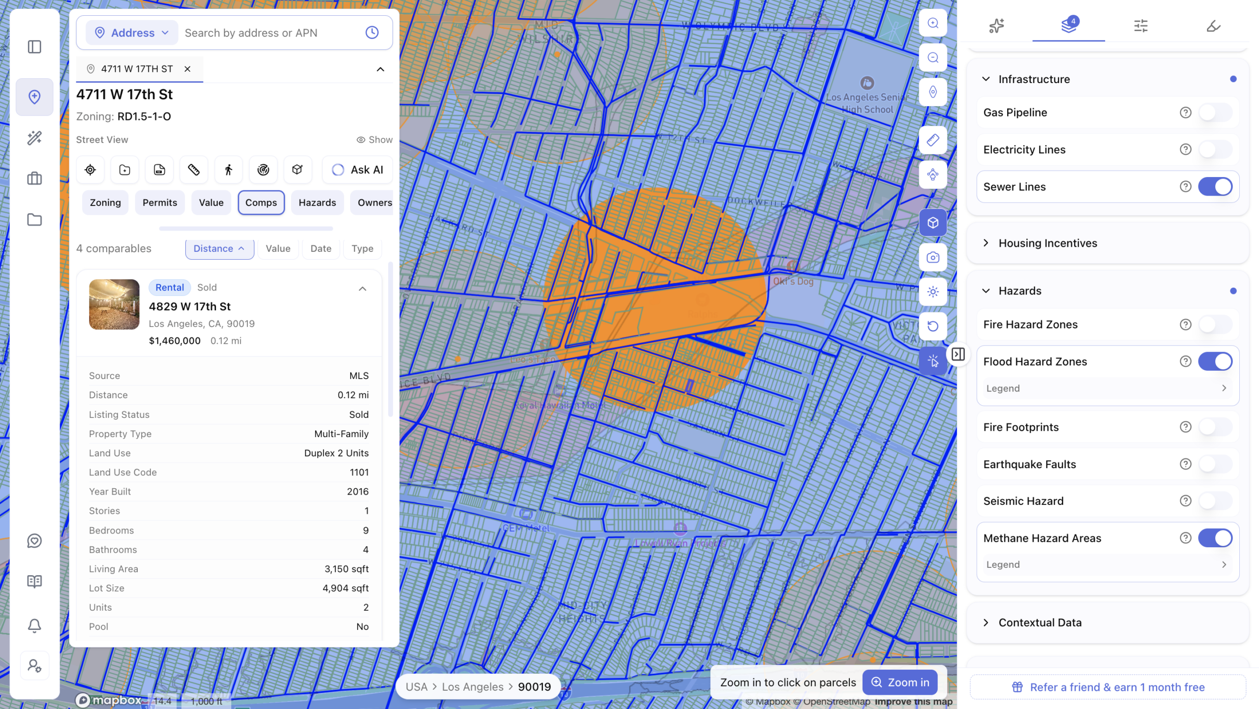
To answer those questions, developers usually check several separate sources: flood maps from the Federal Emergency Management Agency (FEMA), geological data on seismic risk, U.S. Census Bureau numbers on population and income, and real estate listings for nearby rents and sales.
Each of these lives in a different place. Pulling them together for one site can take days. Multiply that across dozens of sites, and it’s easy to see why so much time gets lost before a single offer is even made.
What Is Area Intelligence?
Area Intelligence is the layer of information that sits between “what can I build here?” and “should I build here at all?” It studies the environment, the infrastructure, the people, and the market around a property, then turns all of it into a clear picture of the site’s real potential.
It looks at four things:
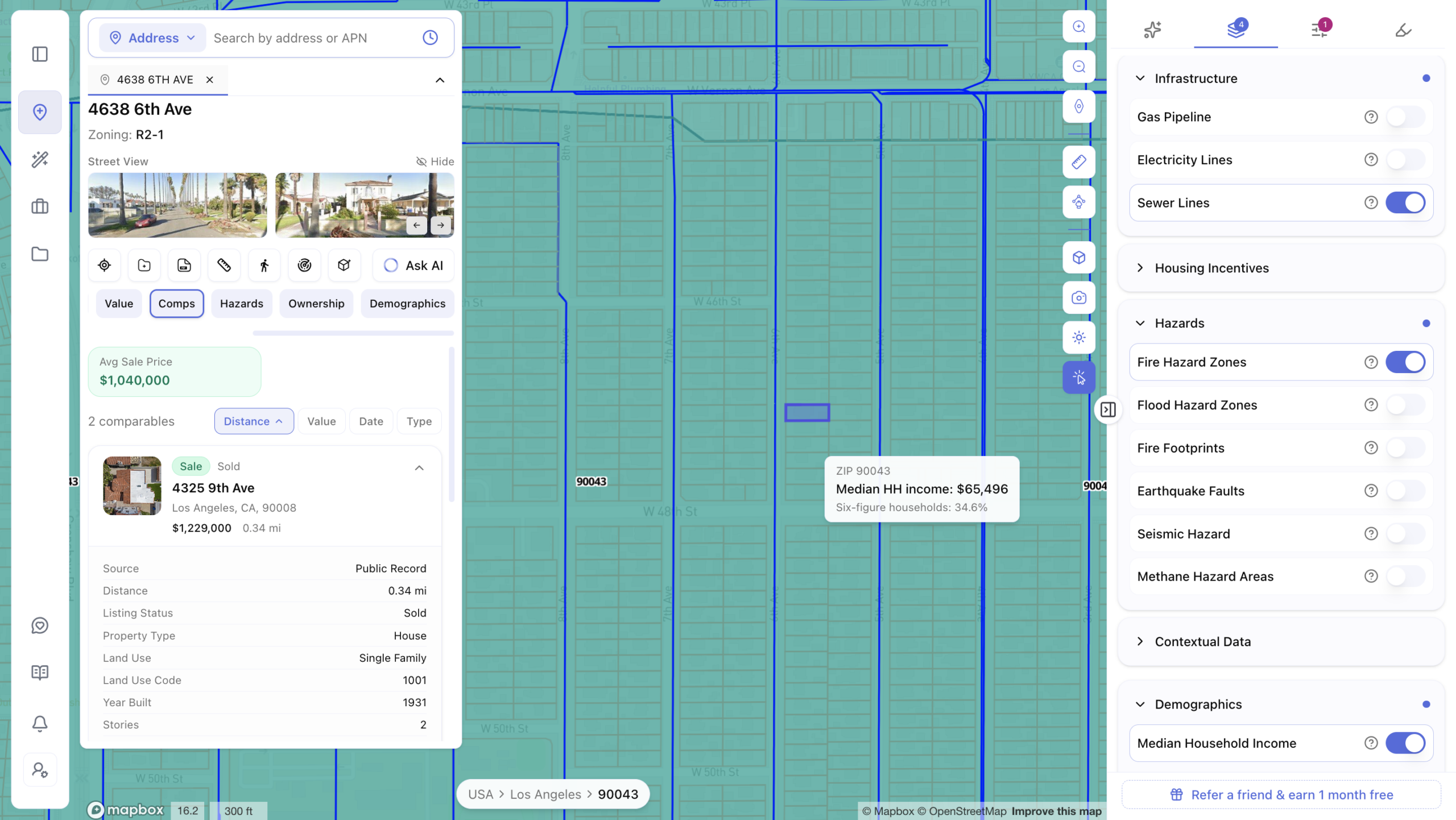
Hazards. Flood zones, seismic risk, contaminated soil, and steep slopes. These issues raise costs and can stop a project before it starts.
Infrastructure. Whether water, sewer, and utility lines can support new construction, and whether new roads or transit lines are planned nearby.
Demographics. Who lives in the area now, and how that is changing. Population growth, income levels, and school quality all shape what kind of building will succeed there.
Market Comps. What’s already being built nearby, how fast it’s renting or selling, and whether the market is healthy or already crowded.
Reliable Area Intelligence tools pull this information from trusted public sources: the U.S. Geological Survey for land and seismic data, FEMA for flood risk, the Environmental Protection Agency for environmental hazards, the U.S. Census Bureau for population data, and the Bureau of Labor Statistics for employment trends. These sources update regularly, so the picture stays current.
How Area Intelligence Improves Site Selection
Once this information sits in one place, site selection changes completely.
It tests your idea about the location, not just your math. A site might allow plenty of units on paper. But if demand isn’t really there, the zoning numbers don’t matter much. Area Intelligence checks whether demand is real before you commit money to a deal.
It finds deal-killing problems early. Flood risk and unstable soil are two of the most common reasons a project stalls or falls apart. Finding these issues in the first week of research, instead of months in, saves both time and budget.
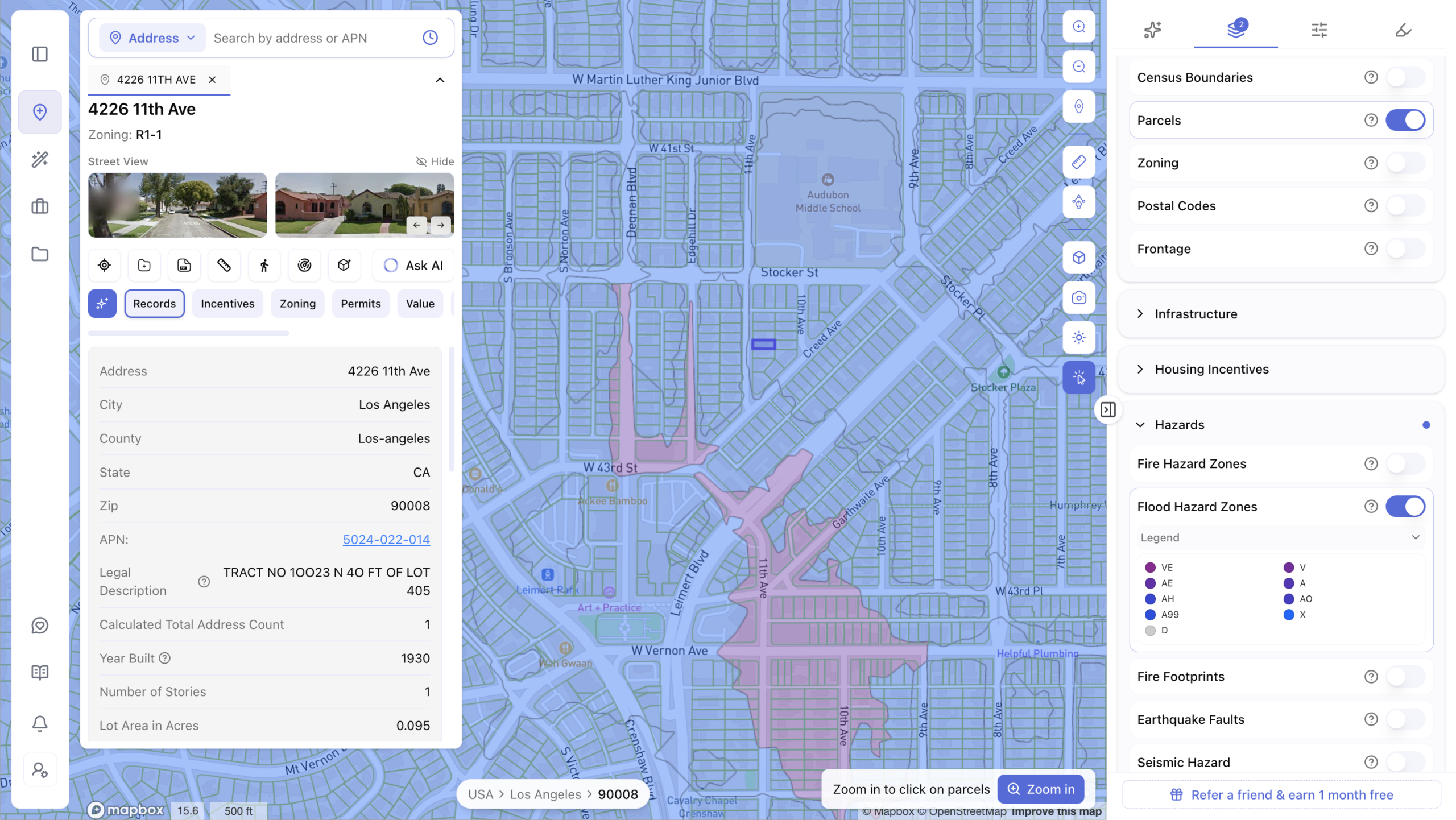
It matches the right building to the right place. A neighborhood full of young professionals wants something different than a neighborhood full of families. Area Intelligence shows you which one you’re dealing with, so you can plan the right unit types from the start.
It gives you room to negotiate. If Area Intelligence flags that a site will need a sewer upgrade, you can bring that to the seller and ask for a lower price. Information found before an offer is leverage. Information found after closing is just a cost.
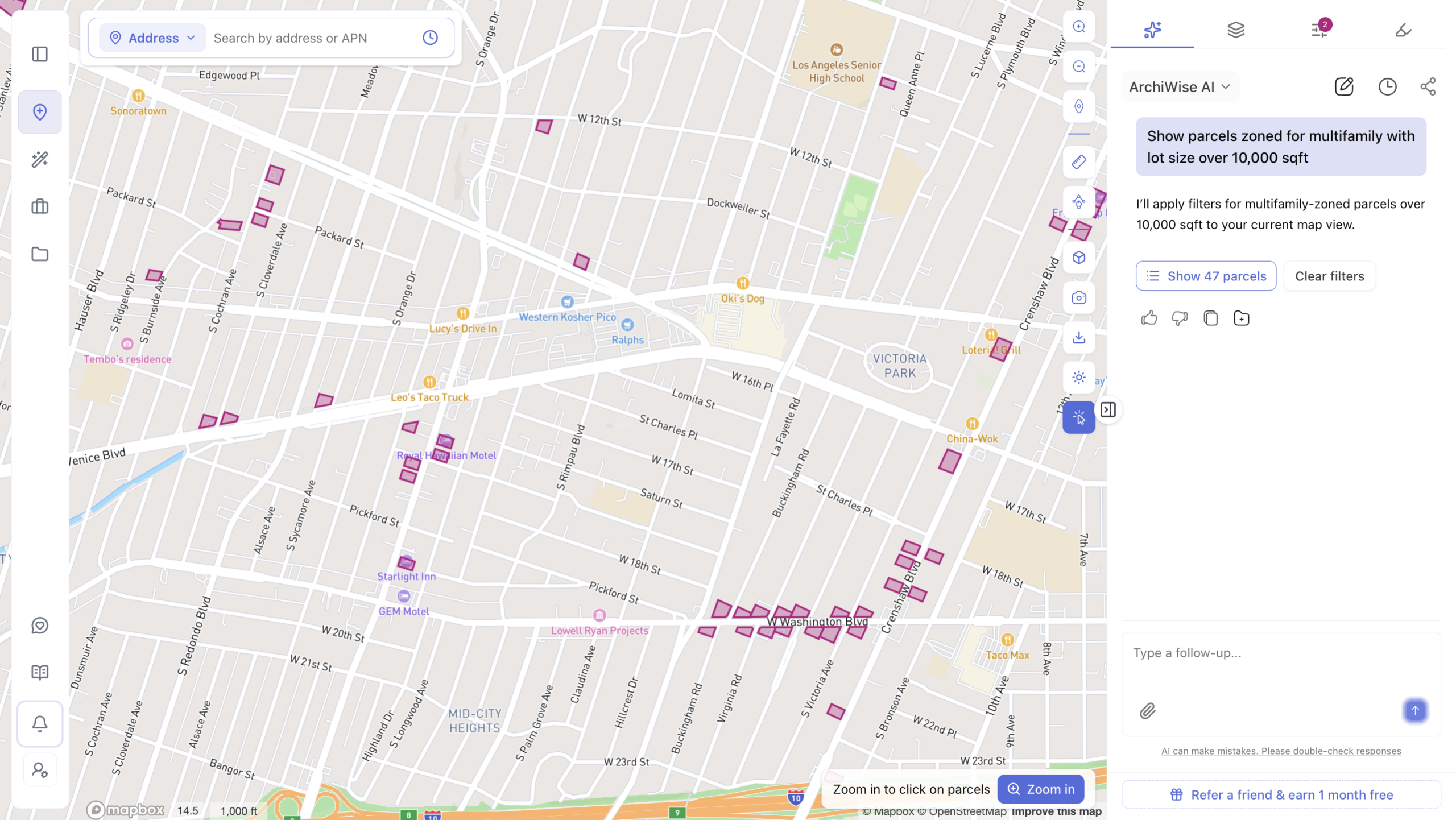
It lets you screen more sites in less time. Instead of ordering separate reports for every property, you get the same information instantly. That means you can look at far more sites, and spend your energy only on the ones worth pursuing.
Why This Matters for Architects, Not Just Developers
Area Intelligence isn’t only useful for the people buying land. Architects benefit just as much.
Hazard and infrastructure data shape the buildable envelope of a site – in plain terms, how much of the lot can actually be used, and how a building needs to be shaped around slopes, soil, or grading limits. Knowing this before design work begins saves time and avoids costly redesigns later.
Demographic and density data also shape early design choices. If an area is filling up with young professionals, a design built around large family units may miss the mark entirely. Area Intelligence helps architects plan unit mix and building massing using real information, not guesswork, long before a design fee is ever discussed.
A Practical Example
Imagine a developer finds a site zoned R-4, on a 12,000-square-foot lot. Zoning allows 28 units with a density bonus. On paper, it looks promising.
Area Intelligence adds the rest of the story. The nearby population of young renters is growing. A local employer is expanding and adding jobs. A new transit station is drawing more riders every year. Local schools are rated highly. Utilities in the area can support new construction without upgrades. There’s no flood risk, and the lot is flat. Nearby rental buildings are leasing quickly, showing there’s still room for more housing, not too much of it.
Every piece of information points in the same direction. That’s the kind of clarity that lets a developer move forward with confidence, instead of hoping for the best.
Area Intelligence in the Full Site Selection Stack
Area Intelligence works best as one part of a larger process. Most site decisions usually involve five steps:
- Find the site – locate parcels with real development potential.
- Check the zoning – confirm what’s legally allowed.
- Run Area Intelligence – confirm the location itself is a good bet.
- Check the numbers – make sure the project actually works financially.
- Estimate approval odds – understand how likely the city is to approve it.
Each step builds on the one before it. Area Intelligence sits right in the middle, connecting “what’s legal” to “what’s smart.”
Quick FAQ
What is pre-development in real estate? Pre-development is everything that happens before construction begins: finding a site, checking zoning, studying the location, and confirming the numbers work.
How do I check zoning for a property? Most cities publish zoning maps and codes through their planning department. Many developers also use zoning software that pulls this information together automatically, saving hours of manual searching.
What can I build on my property? This depends on your local zoning code, which sets rules for building height, unit count, setbacks, and lot coverage. A zoning analysis tool can show you these rules in minutes instead of days.
Conclusion
Site selection has always come down to one question: where should we build? For a long time, the answer stopped at zoning. But zoning only tells you what’s legal. It never tells you what will actually work.
Area Intelligence closes that gap. It brings hazard data, infrastructure details, demographic trends, and market activity into one clear picture, so you know if a location will support your investment before you spend a single dollar on it.
Ready to Stop Guessing and Start Knowing?
Every week spent digging through flood maps, census data, and market reports is a week a competitor might use to close a deal you never even saw coming. The developers winning right now aren’t smarter. They just have better information, faster.
Don’t let your next great site slip away because a hidden risk showed up too late.
Book your free ArchiWise demo today and see exactly what a property can become – backed by real data, in minutes instead of weeks.
Learn more
ArchiWise helps developers, investors, architects, and brokers go from address to decision in minutes, not weeks.
Whether you’re screening sites for multifamily development, evaluating zoning constraints, surfacing incentive eligibility like QCT and LIHTC, or assessing hazard risk before committing capital, ArchiWise runs every layer of analysis in one place.
Explore how ArchiWise helps teams screen development sites, analyze zoning, and make confident go/no-go decisions faster.