
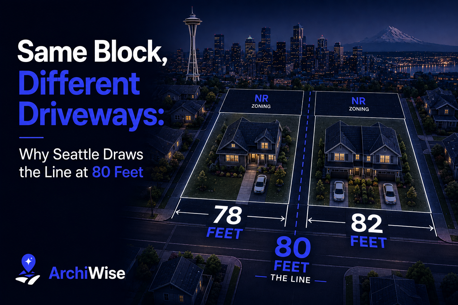

Two lots. Same block. Same zoning. One is 78 feet wide. The other is 82.
Nothing about that four-foot gap shows up on a listing sheet. It won’t change the price per square foot. But in Seattle, it can be the difference between a site plan with one driveway and a site plan with two – and by the time most developers find that out, the architect has already drawn the parking layout.
The Rule Hiding in Plain Sight
In Seattle’s Neighborhood Residential zones (NR1, NR2, NR3 – the former “single-family” zones) and Residential Small Lot (RSL) zones, the number of curb cuts a lot is allowed comes from Seattle’s general curb-cut standard, SMC 23.54.030(F), applied to these zones through SMC 23.44. The code’s preference is alley access, where feasible. But when a lot has to take its parking access from the street instead, the standard has historically worked out to: only one 10-foot curb cut permitted for every 80 feet of lot frontage.
Read that again. Not per lot. Per 80 feet.
A standard 50-foot or 60-foot lot in Seattle’s neighborhood residential zones? One curb cut, full stop. A lot with more than 80 feet of frontage – whether it started that way or got there through a lot merger or assemblage – can potentially support a second one.
And the ratio isn’t even flat forever. City ordinance text shows it tapers for very large lots: once frontage exceeds 480 feet, the allowance shifts to one curb cut for every 120 feet instead of 80. Most residential lots will never get close to that threshold – but it’s a good reminder that “one number” rules in zoning codes often have more steps hiding underneath them than a summary sentence can capture.
One honest caveat: Seattle rewrote large parts of its Neighborhood Residential zoning in 2025 to comply with state middle-housing law (height limits, floor area, and setbacks all shifted). This specific frontage ratio is well-documented in pre-2025 zoning summaries and lines up with how SDCI and SDOT describe curb cut counts today – but on a project with real money behind it, always confirm the current figure against the live code rather than a blog post, this one included.
Why Four Feet Can Change a Whole Site Plan
This matters most in exactly the kind of project Seattle is trying to encourage right now: cottage housing, rowhouses, townhouses, and small-lot infill on RSL-zoned land. These housing types often put multiple principal units on a single lot – and every one of those units needs a way to get a car in and out.
If the lot’s frontage sits just under that 80-foot threshold, the whole development may be forced onto one shared driveway – which changes unit layout, changes how many units can realistically be built with dedicated parking, and sometimes changes whether the project pencils at all. If the frontage clears 80 feet, a second curb cut can open up an entirely different, more flexible site plan.
There’s a related detail worth knowing if a rowhouse or townhouse project spans more than one lot – a common setup when a developer assembles adjacent parcels for a larger project. City code sets a minimum spacing of 18 feet between curb cuts on paired driveways serving attached units across those lots. It’s a small number, but it directly shapes how many separate access points a multi-lot rowhouse project can actually fit along the block – on top of, not instead of, the 80-foot frontage math.
Why the underlying rule exists at all is its own small piece of city history. Many of Seattle’s older residential blocks – Capitol Hill, Wallingford, Ballard – were originally platted with rear alleys specifically so houses wouldn’t need street-facing driveways in the first place. The 80-foot curb-cut math only kicks in when alley access isn’t feasible, which is exactly the situation a lot of infill and small-lot development runs into on blocks where the alley was never built out, is too narrow, or doesn’t reach the parcel in question.
And the number itself isn’t universal – sometimes not even within one city. New York City, for comparison, sets its bar much lower: under its zoning resolution, certain lower-density residential districts cap a lot with less than 50 feet of street frontage to one curb cut; clear 50 feet, and it may qualify for two. NYC’s code also uses a separate 33-foot threshold elsewhere, governing driveway width rather than curb cut count – two different numbers, from two different provisions, both real. Seattle’s 80-foot threshold is far more generous than either. A rule of thumb from one city – or even one section of one city’s code – can actively mislead a developer working from memory instead of the current text. There isn’t a universal number to memorize; there’s only the number for the parcel and jurisdiction in front of you.
None of this shows up during initial site selection. It surfaces later – when a civil engineer sits down to draft the access plan and someone finally measures the frontage properly, or when the curb cut permit application goes to Seattle’s Department of Construction and Inspections and Department of Transportation for review and comes back with a different number than the site plan assumed. By then, a design has often already been drawn around an assumption that turns out to be wrong.
Archiwise Already Has This Number Waiting
This is exactly the kind of detail Archiwise’s Frontage map layer was built to surface – one of the Property Data layers, alongside Boundaries, Parcels, and Zoning, currently available for Seattle. Toggle it on, and every parcel on the map shows its exact frontage footage, labeled right on the map, for an entire Seattle block or neighborhood at once. No survey to pull, no manual measurement, no guessing whether a lot clears the threshold that decides how many curb cuts it qualifies for.
Let’s see how it actually works.
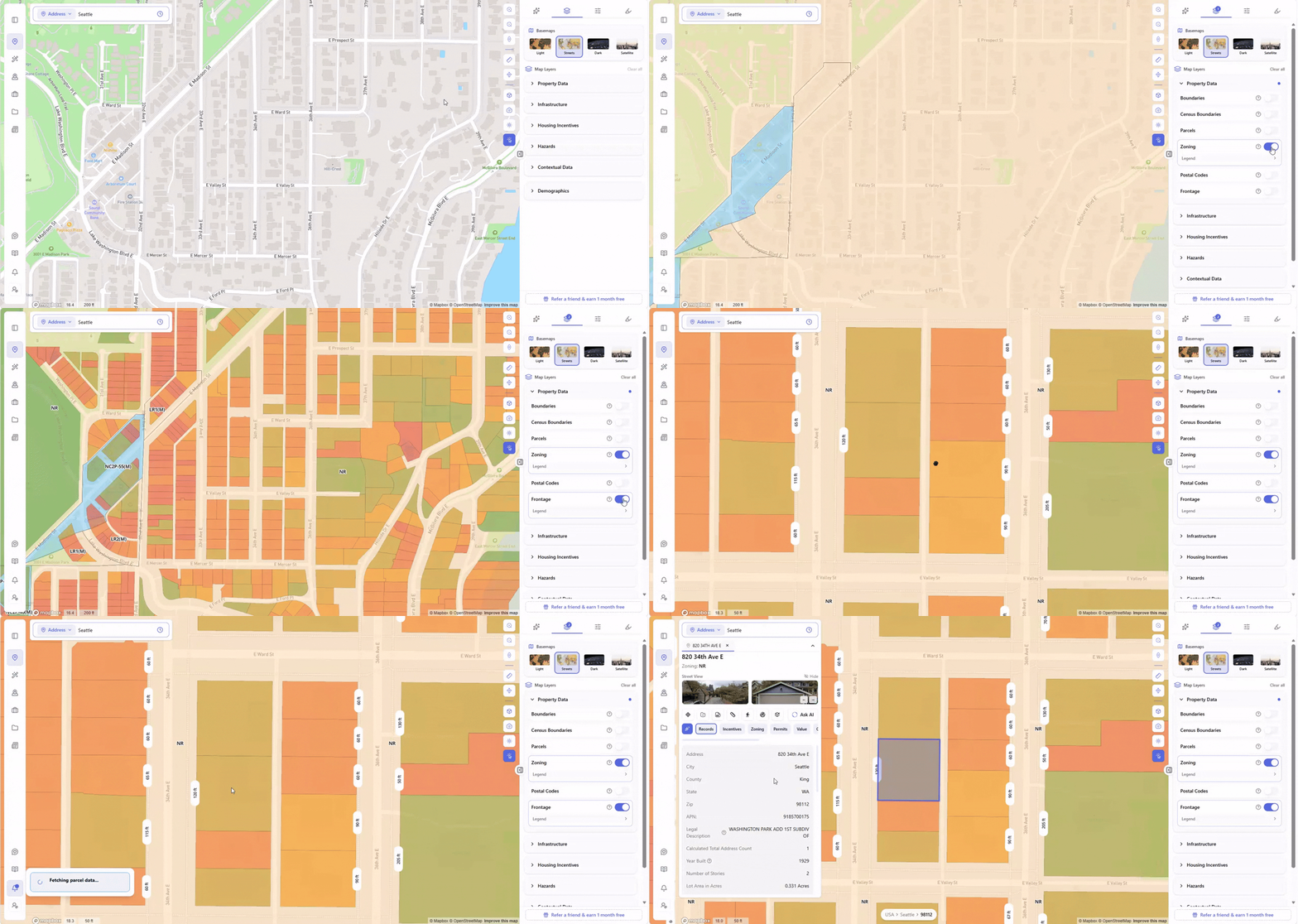
Search any Seattle block, toggle Frontage on, and the numbers appear directly on each parcel. 820 34th Ave E (zip 98112), for example, sits on an NR-zoned lot with 120 feet of frontage – comfortably clear of the 80-foot threshold, meaning a second curb cut is potentially on the table if this lot were redeveloped. A few parcels over on that same block, several neighboring lots show just 60 feet of frontage each – one curb cut, full stop, no matter how the site gets designed. Same zone, same block, a completely different constraint depending on which parcel you’re standing on – and it’s visible on the map before a single call to the city.
That’s the real value of seeing frontage as a map layer instead of a spreadsheet column: it turns an abstract threshold into something you can see the moment you scan a block, parcel by parcel, without opening a single lot’s file to find out where it lands.
The Old Way to Catch This
Checking lot frontage before it becomes a problem usually means pulling a recorded plat map from the King County Recorder’s Office (or a current dimension outline from the Assessor’s Parcel Viewer, which King County itself notes isn’t a substitute for a licensed survey), and then manually working through SMC 23.44 and SMC 23.54.030 to figure out what that frontage number actually permits. For one lot, that’s a manageable ten minutes. For a block of ten candidate sites, it’s an afternoon that most developers don’t have.
For a developer screening sites in Seattle’s Neighborhood Residential or RSL zones, that’s the difference between discovering an 80-foot rule during design and seeing it on the map before an offer is even drafted.
The Bottom Line
A four-foot difference in frontage shouldn’t be the thing that quietly reshapes a project’s parking plan three months into design. It should be something you see on the map before you ever make an offer.
Check the frontage before you draw the site plan.
Learn more
ArchiWise helps developers, investors, architects, and brokers go from address to decision in minutes, not weeks.
Whether you’re screening sites for multifamily development, evaluating zoning constraints, surfacing incentive eligibility like QCT and LIHTC, or assessing hazard risk before committing capital, ArchiWise runs every layer of analysis in one place.
Explore how ArchiWise helps teams screen development sites, analyze zoning, and make confident go/no-go decisions faster.